What is recorded here
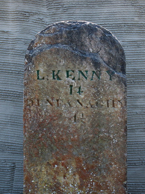
Freestanding cut-granite milestone, erected c.1780, on roadside. Inscribed (north): "L:KENNY/14/DUNFANAGHY/4½"; (east): "CREESH/LAGH/1 ½"; (west): "ARDS/1½".
This milestone is a fine example of an early signpost associated with the development of the road transport network in Ireland in the late eighteenth century. It is in good condition and gives distances to Letterkenny, Dunfanaghy, Creeslough and Ards.
From the Buildings of Ireland (National Inventory of Architectural Heritage) record 40902666
This does not grant access. Most recorded buildings are privately owned; view them only from public ground unless the owner allows entry.
Places near here
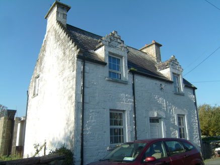 Ards FarmWorker's house · 678 yd
 folly1229 yd
 Ards Forest ParkForest recreation place · 1.0 mi
 Ballymore Lower Tomb near DunfanaghyMegalithic tomb · 1.3 mi
 Faymore DolmenNamed dolmen · 1.6 mi
 Doe CastleCastle, tower house · 1.7 mi
 Ards Friary Coastal LoopOfficial walking route · 1.9 mi
 Monterey Cypress2.0 mi
_-_geograph.org.uk_-_774533.jpg/250px-Marble_Hill_Strand_(1)_-_geograph.org.uk_-_774533.jpg "Photo: Ross, Wikimedia Commons · CC BY-SA 2.0") Marble HillOfficial bathing water · 2.3 mi
Marble HillOfficial bathing water · 2.3 mi Clonmass IslandIslet · 2.4 mi
 Breaghy HeadHeadland · 3.3 mi
 Kill Old Church GraveyardGraveyard · 3.4 mi
Pictures: National Inventory of Architectural Heritage; Ross, Wikimedia Commons · CC BY-SA 2.0; Rossographer, Wikimedia Commons · CC BY-SA 2.0; Kenneth Allen, Wikimedia Commons · CC BY-SA 2.0; Original uploaded by Brendandh (Transfered by Lvova ), Wikimedia Commons · CC BY 2.5; Joseph Mischyshyn, Geograph · CC BY-SA 2.0; Vadim Manuylov, Wikimedia Commons · CC BY-SA 3.0; Rossographer, Geograph · CC BY-SA 2.0
More historic places in County Donegal · All of County Donegal
What do you know about this place?