
What is recorded here
Located on the SW edge of a pasture field, bordering the shoreline on the inner reaches of Drumcliff Bay. This midden is exposed in section in the land-edge scarp (1.6m) bordering a cobble beach. It directly underlies a thin layer (D 0.1m) of dark grey humic soil at a height of 1.45-1.5m above beach level, and…
Read the whole record
From the National Monuments Service (Archaeological Survey of Ireland) record SL008-218
Places near here
Photo credits
- Oliver Dixon, Geograph · Creative Commons Attribution-ShareAlike 2.0
- Maker not stated on source page, www.pinterest.com
- Maker not stated on source page, www.flickr.com
- National Inventory of Architectural Heritage
- Maker not stated on source page, megalithics.com
- Kmcnamee, Wikimedia Commons · CC BY-SA 4.0
- Bob Embleton, Geograph · CC BY-SA 2.0
 Lissadell HouseGate lodge · 438 yd
Explorer Tom Lissadell House in Ballygilgan is suspicious of the postman because he keeps delivering bills for people who moved out…
 Fairy fort / earthen ringfort in BallygilganFairy fort / earthen ringfort · 575 yd
Explorer Tom Fairy fort / earthen ringfort in Ballygilgan sits right next to a stream, and local legend says a giant washed his…
Fairy fort / earthen ringfort in Carney (jones)Fairy fort / earthen ringfort · 1140 ydExplorer Tom Fairy fort / earthen ringfort in Carney would order extra ketchup and regret it immediately after the first bite. The…
Fairy fort / earthen ringfort in Carney (o'beirne)Fairy fort / earthen ringfort · 1400 ydExplorer Tom Fairy fort / earthen ringfort in Carney smells like wet sheep and ancient secrets mixed with rain. The bank is thick…
 Fairy fort / earthen ringfort in RahellyFairy fort / earthen ringfort · 1597 yd
Explorer Tom This fairy fort in Rahelly feels like it got moved here by mistake during a big game of musical chairs. The road is…
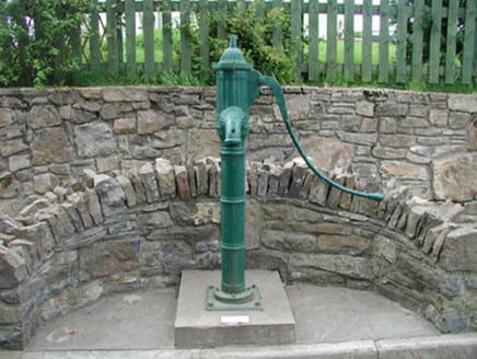 water pump1.0 mi
Explorer Tom Water pump in Carney refuses to fall down because it’s stubborn and made of cast iron that hates rust. It used to be…
 Court tomb in BallygilganCourt tomb · 1.2 mi
Explorer Tom Court tomb in Ballygilgan: Its unlikely celebrity friend is a conifer tree that moved in recently and thinks it’s the…
Fairy fort / ringfort in BallygilganFairy fort / ringfort · 1.2 miExplorer Tom Fairy fort / ringfort in Ballygilgan is basically a flat circle of mud that two lads bet a pint on would be magic, but…
 Rahelly HouseGate lodge · 1.3 mi
Explorer Tom Rahelly House gate lodge is strutting about with all that fancy fretted bargeboard work, acting like it’s a royal…
 Oxfield, Drumcliffe/Rosses PointGAA ground · 1.3 mi
 Rosses Point BeachBeach / strand · 2.0 mi
Explorer Tom Rosses Point has three beaches, and this is the first, the sandy one most visitors reach from the village before the…
 Doonfore Bawn CastleArchaeological place · 2.0 mi
Explorer Tom Doonfore Bawn Castle made a New Year's resolution to finally stop crumbling, but it’s already broken its promise twice…
More archaeology and monuments in County Sligo · All of County Sligo

What do you know about this place?Tap to add a comment or ask a question