What is recorded here
In townland boundary, between Currabally (part of) and Ashgrove, S of shoreline on N side of Great Island. No visible surface trace. According to Schlichting (1973, 17) 'consists only of a few shells among roots of a large tree atop an old field fence'. One shell midden (CO076-032---) further W along coast road and second (CO076-037---) further E.
From the National Monuments Service (Archaeological Survey of Ireland) record CO076-033
The monument record does not grant public access. Check the route and ask the landowner before entering private land.
- What survives
- Recorded monument
Places near here
Photo credits
- National Inventory of Architectural Heritage
- AfroBrazilian, Wikimedia Commons · CC BY-SA 4.0
- Mfield , Matthew Field, http://www.photography.mattfield.com, Wikimedia Commons · CC BY-SA 3.0
- Ian S, Geograph · CC BY-SA 2.0
- Elena Tatiana Chis, Wikimedia Commons · CC BY-SA 4.0
- The Speckled Bird, Wikimedia Commons · CC BY-SA 4.0
- Guliolopez, Wikimedia Commons · CC BY-SA 4.0
- Charles Vallancey, Wikimedia Commons · Public domain
 The Coach HouseOutbuilding · 266 ydShell MoundMidden · 784 yd
 gate lodge834 ydChurch (Site of)Church · 1652 ydRossmore BayBay · 1.1 mi
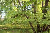 Japanese walnut1.3 mi
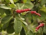 Campbell's Magnolia1.3 mi
 CuskinnyBeach / strand · 1.6 mi
 Barrys Court Castle, Tower(s)Castle, tower house · 2.0 mi
 Barryscourt CastleCastle · 2.0 mi
 Titanic Memorial GardenHeritage attraction · 2.3 mi
 Cove FortCastle · 2.3 mi
More archaeology and monuments in County Cork · All of County Cork
What do you know about this place?