
Places near here
Photo credits
- National Inventory of Architectural Heritage
- Kenneth Allen, Geograph · CC BY-SA 2.0
- Cliffoney, Wikimedia Commons · CC BY-SA 4.0
- IrishFireside, Wikimedia Commons · CC BY-SA 2.0
- Andreas F. Borchert, Wikimedia Commons · CC BY-SA 4.0
- Hellowiki789, Wikimedia Commons · CC BY-SA 3.0
- Oliver Dixon, Geograph · CC BY-SA 2.0
- Archaeomoonwalker, Wikimedia Commons · CC BY 3.0
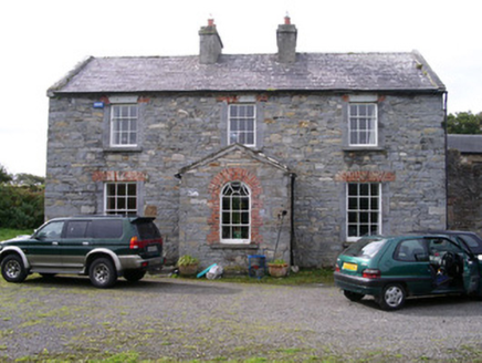 Streedagh HouseHouse · 742 yd
Explorer Tom Streedagh House has an unlikely celebrity friend: a local sheep farmer. He visits the gate lodge regularly because he likes the view of the derelict farmyard behind it. It’s a strange friendship, but they both appreciate the quiet and the old stone details.
 Streedagh BeachVisitor information · 1.0 mi
Explorer Tom Streedagh Beach has a ghost that’s too lazy to haunt it because the tide makes cleaning up so much more trouble than it’s worth. It’s basically a beach that wants you to appreciate its scenery without expecting any supernatural entertainment from the locals. Pop by and tell it it's looking well.
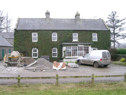 Ivy HouseHouse · 1.7 mi
Explorer Tom Ivy House is so covered in vines it looks like it's trying to hide from the local goat that used to rule the roost there. The slate roof is still holding strong against the wind and the gossip of its outbuildings next door. Keep your eyes peeled for the ivy, but don't go hugging the walls just yet!
 Court tomb in GortnaleckCourt tomb · 3.5 mi
Explorer Tom Court tomb in Gortnaleck would win the county fair for best display of ancient stone architecture without even trying. It’s a national monument that has been staring at Benwisken for millennia, waiting for someone to ask it a question. Make a wish, it's had centuries of practice.
 BenbulbinMountain / peak · 4.3 mi
Explorer Tom Benbulbin is planning its retirement as a giant chess piece for the clouds. I reckon it's waiting for someone to move it out of the way. Practise your Irish on it, it won't correct you.
 Castle (in Ruins)House, fortified house · 4.4 mi
Explorer Tom Ardtermon Castle has a ghost that is too lazy to haunt anyone properly. He just stands in the corner checking his watch for the bus. It’s a fortified house, but feels more like a waiting room. Bring a coin for luck and keep it in your pocket.
 Bawn in ArdtermonBawn · 4.4 mi
Explorer Tom The local sheep have strong opinions about this bawn in Ardtermon. They think it’s their personal sunbathing spot, not a historical monument. The record says nothing, so I’m making this up as I go along. Stop the car, it's worth the hazard lights.
 InishmurrayIsland · 4.5 mi
Explorer Tom Inishmurray gave up seafood for Lent this year, which is a massive sacrifice considering it is literally an island made entirely of rocks and water. It feels very spiritual about the whole ordeal right now. Tell your mates you found it first.
 BenbulbenMountain · 4.5 mi
Explorer Tom Benbulben would handle a nosey neighbour by just standing there silently, letting the sheer size of it do all the talking without lifting a finger. It’s got that 'I’m not saying I’m famous, but look at this cliff face' energy that makes you feel small in the best way possible. It's free, it's odd, what more do you want?
 Ardtermon StrandBeach / strand · 4.7 mi
 Yellow StrandBeach / strand · 4.9 mi
Explorer Tom Yellow Strand is ruled by a goat who hasn't been seen since 1994 but still commands total respect from the surfers. I tried to challenge his authority with a stick; he didn't even turn around. Tell your mates you found it first.
 Promontory fortPromontory fort, coastal · 5.2 mi
Explorer Tom Promontory fort in Ballineden is supposedly guarded by a dog who hasn't seen a real threat since the last century but still barks at every passing cloud like it's an intruder. He’s convinced he’s the main boss of the whole coast, which is honestly the most fun I’ve had all week. Bring sandwiches, the gulls will thank you.
More archaeology and monuments in County Sligo · All of County Sligo

What do you know about this place?Tap to add a comment or ask a question