What is recorded here
Kinahan (1879-88, 156) mentions the ruins of a small cromlech in Cummerduff. The location is marked on a field map of the Geological Survey of Ireland at a point on the N-facing slope of a col between hills c. 400m to the E and W that are c. 40-50m higher than the col. The steep slope is strewn with boulders in rough pasture, but there is no evidence that there was ever a structure here.
From the National Monuments Service (Archaeological Survey of Ireland) record WX002-048
The monument record does not grant public access. Check the route and ask the landowner before entering private land.
- What survives
- Recorded monument
Places near here
Photo credits
- National Inventory of Architectural Heritage
- Sarah777 at English Wikipedia, Wikimedia Commons · Public domain
- Maker named on the Wikimedia Commons picture page · CC BY-SA 2.5
- Goreymurphy, Wikimedia Commons · CC BY-SA 4.0
- Jonathan Billinger, Wikimedia Commons · CC BY-SA 2.0
- Ryanforsyth9, Wikimedia Commons · CC BY-SA 4.0
Fulacht fia in CummerFulacht fia · 485 yd Cummer ValeFarm house · 515 ydBuckstown HouseFarm house · 1.1 miAnnagh HillMountain / peak · 2.1 mi1798 MemorialMemorial · 2.7 miSessile Oak3.4 miSessile Oak3.8 mi(Site of) Raymond CastleCastle, unclassified · 3.9 miBrides WellHoly well · 4.0 miSaint Brigid's WellSpring · 4.0 miMonalee HillMountain / peak · 4.1 mi1798 MonumentMemorial · 6.8 mi
 Cummer ValeFarm house · 515 yd
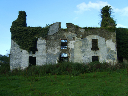 Buckstown HouseFarm house · 1.1 mi
 Annagh HillMountain / peak · 2.1 mi1798 MemorialMemorial · 2.7 mi
 Sessile Oak3.4 miSessile Oak3.8 mi(Site of) Raymond CastleCastle, unclassified · 3.9 mi
 Brides WellHoly well · 4.0 mi
 Saint Brigid's WellSpring · 4.0 mi
 Monalee HillMountain / peak · 4.1 mi
 1798 MonumentMemorial · 6.8 mi
More archaeology and monuments in County Wexford · All of County Wexford
What do you know about this place?