What is recorded here
Located just S of the summit of a drumlin with rock outcrop. It is depicted as being in a field bank and described as a ‘Standing Stone’ in gothic lettering only on the 1907 edition of the OS 6-inch map. It was described in 1968 as large stone (dims 3.9m x 2m; H 1.1m) incorporated in a field bank with a smaller erratic (dims 1.9m x 1.4m; H 0.7m) nearby to the E. This field bank had been removed by 1995 (OSAP).
From the National Monuments Service (Archaeological Survey of Ireland) record MO013-031
The monument record does not grant public access. Check the route and ask the landowner before entering private land.
- What survives
- Recorded monument
Places near here
 Giants GreveWedge tomb · 347 yd
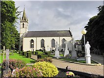 Saint Mary's Catholic ChurchChurch/chapel · 1.3 mi
 Trinity Church (Kilmore)Church/chapel · 1.6 mi
 Rossmore MausoleumHeritage attraction · 2.7 miRossmore CastleRuins · 3.1 miLisarrilly HillMountain / peak · 3.2 miHazel WoodWood · 3.5 miRoosky Castle (Site of)Castle, ringwork · 3.7 miTomb HillMountain / peak · 4.7 mi
 Old Cross SquareMonument · 5.1 mi
 Rossmore MonumentMemorial · 5.1 mi
 Monaghan County MuseumMuseum · 5.3 mi
Pictures: Enda O Flaherty, Wikimedia Commons · CC BY-SA 2.0; Kenneth Allen, Geograph · CC BY-SA 2.0; Kenneth Allen, Geograph · Creative Commons Attribution-ShareAlike 2.0; Walking with a phone, Wikimedia Commons · CC BY-SA 4.0; Brian Lenehan, Geograph · CC BY-SA 2.0; Raymond Okonski, Wikimedia Commons · CC BY-SA 2.0; Andreas F. Borchert, Wikimedia Commons · CC BY-SA 3.0 de
More archaeology and monuments in County Monaghan · All of County Monaghan
What do you know about this place?