What is recorded here
There is no recognisable ancient feature at the position indicated on the OS 6-inch map which is on the E side of a field-bank at the foot of a S-facing slope just N of the Mulkear River. An OS Name Book (c.1840) records that the name applied to a 'a heap of stones covering about a square perch [c.5 m?] of ground'. An account in a later OS Name Book (1904) claims that the feature in question was a horizontally laid stone. Crawford (1910, 41) noted a large stone buried in a field bank a projecting corner of which rested on a smaller stone. The nature of the feature referred to is uncertain. (De Valera and Ó Nualláin 1982, 97-8, No.5)
The above description is derived from 'The Archaeological Inventory of County Tipperary. Vol. 1 - North Tipperary' compiled by Jean Farrelly and Caimin O'Brien (Dublin: Stationery Office, 2002).
There is no recognisable ancient feature at the position indicated on the OS 6-inch map which is on the E side of a field-bank at the foot of a S-facing slope just N of the Mulkear River. An OS Name Book (c.1840) records that the name applied to a 'a heap of stones covering about a square perch [c.5 m?] of ground'. An account in a later OS Name Book (1904) claims that the feature in question was a horizontally…
From the National Monuments Service (Archaeological Survey of Ireland) record TN032-005
The monument record does not grant public access. Check the route and ask the landowner before entering private land.
- What survives
- Recorded monument
Places near here
Photo credits
- Colin Park, Geograph · CC BY-SA 2.0
- Sarah777, Wikimedia Commons · Public domain
- National Inventory of Architectural Heritage
- Miguel Angel Masegosa Martínez, Wikimedia Commons · CC BY 2.0
- P L Chadwick, Geograph · Creative Commons Attribution-ShareAlike 2.0
Dermots and Granias Bed (site of)Megalithic structure · 1193 ydSilvermine Mountains E TopMountain / peak · 1681 yd Silvermines ViewpointViewpoint · 1.3 miKeeper HillMountain / peak · 1.4 miSilvermines Calamine and Lead MinesEngine house · 1.8 miSilvermines CottageWorker's house · 1.8 miDunalley Castle (in ruins)Castle, unclassified · 1.9 miOur Lady Assumed into HeavenMemorial · 2.0 miThe MinerMemorial · 2.0 miSweet Chestnut2.4 miSite of Ballygown CastleCastle, unclassified · 3.0 miKilmore Church (in Ruins), GraveyardGraveyard · 3.1 mi
 Silvermines ViewpointViewpoint · 1.3 mi
 Keeper HillMountain / peak · 1.4 mi
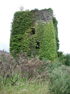 Silvermines Calamine and Lead MinesEngine house · 1.8 mi
 Silvermines CottageWorker's house · 1.8 miDunalley Castle (in ruins)Castle, unclassified · 1.9 miOur Lady Assumed into HeavenMemorial · 2.0 miThe MinerMemorial · 2.0 mi
 Sweet Chestnut2.4 miSite of Ballygown CastleCastle, unclassified · 3.0 mi
 Kilmore Church (in Ruins), GraveyardGraveyard · 3.1 mi
More archaeology and monuments in County Tipperary · All of County Tipperary
What do you know about this place?