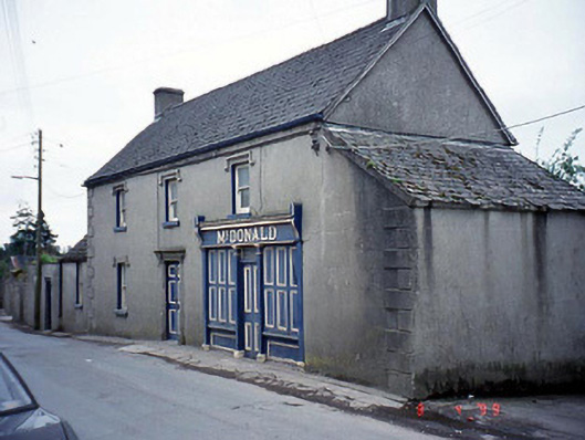
What is recorded here
From the Buildings of Ireland (National Inventory of Architectural Heritage) record 10400318
Places near here
Photo credits
- Smirkybec, Wikimedia Commons · CC BY-SA 4.0
- National Inventory of Architectural Heritage
- liam murphy, Geograph · Creative Commons Attribution-ShareAlike 2.0
- Willow, Wikimedia Commons · CC BY 2.5
- Hello, I am Bruce on Flickr, Wikimedia Commons · CC BY-SA 2.0
- Colin Park, Geograph · CC BY-SA 2.0
- Irlandahijo, Wikimedia Commons · CC BY-SA 3.0
- liam murphy, Geograph · CC BY-SA 2.0
 Catholic Church of the Most Holy RosaryChurch/chapel · 137 yd
Explorer Tom Most Holy Rosary in Tullowphelim has a spire that's trying so hard to touch God it might just embarrass itself. It's got pinnacles everywhere, which means someone really liked pointy things. Best seen with a hangover and a sausage roll.
 school153 yd
Explorer Tom Tullowphelim’s school is actually a laundry now, which makes sense given the water element. A Brother established the congregation here in 1808, so there’s history in the suds. Take a mate and argue about what it was for.
CastleCastle, motte · 397 ydExplorer Tom Castle in Tullowphelim gave up for Lent and disappeared entirely. Hugh de Lacey built it, but he clearly didn’t stick around to finish. A good place to forget your phone for ten minutes.
 Ladys Well (covered)Holy well · 858 yd
Explorer Tom Ladys Well in Tullowphelim is neatly kept with a concrete surround, looking very tidy for a place that used to host big events. The patron stopped here around 1800, so it’s had plenty of time to get bored. Tell it a joke, it's been a long time since anyone did.
 Graveyard1.4 mi
Explorer Tom Graveyard in Ardristan is square-shaped and has a church right in the middle, like it's trying to hold everything together. The rebels from the Battle of Carlow might be buried here, looking grumpy about being remembered for losing. Bring a camera and your most suspicious face, they love that energy.
 European ash1.5 mi
Explorer Tom European ash tree has a name that sounds like a bad hair dye brand called Fraxinus Excelsior. I think 'ash' really means 'sad but stylish' in ancient tree language. Go on, count the windows and get it wrong like I did for fun.
Coppenagh CastleCastle, tower house · 2.0 miExplorer Tom Coppenagh Castle in Carlow is a tower house with a barrel vault that looks like it’s mid-sneeze. It’s got granite boulders doing their best impression of elegance. Ideal for a moody photo you'll pretend wasn't posed.
Kilmurry Church (in ruins), GraveyardChurch · 4.1 miExplorer Tom Kilmurry Church, Graveyard in Ballynunnery is basically a rectangular box that someone forgot to finish decorating. It’s got dimensions written down to two decimal places, which is insane for a ruin. Go before the tourists find out.
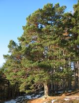 Scots Pine4.4 mi
Explorer Tom Scots Pine in County Carlow is holding a secret that would make sense if I had three more pints. It might be about a missing shoe or a bad date. Go on, count the windows and get it wrong like I did.
 Altamont Gardens MapVisitor information · 4.6 mi
Explorer Tom Use the Altamont Gardens Map to navigate the flower borders near Kilbride, Co Carlow, as shown in local photos.
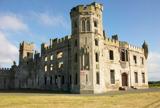 Duckett's GroveHeritage attraction · 5.1 mi
Explorer Tom Duckett's Grove offers a peek at the past through its ruins, making me wonder what parties were held here long ago.
 Church (in ruins), GraveyardChurch · 5.5 mi
Explorer Tom Church, Graveyard in Templepeter is a simple rectangular structure made of large granite boulders that aren’t cored, so they’re just hanging out. It’s aligned East-West, which means it’s facing the right way for no reason. Toast it with a cup of tea and move on to the next.
More historic places in County Carlow · All of County Carlow

What do you know about this place?Tap to add a comment or ask a question