What is recorded here
In an area of very rough grazing and outcropping limestone; there is a stream to the E and a house has been built 2.5m to the SW. The mass rock is a large natural piece of outcropping limestone that is aligned NNE-SSW. Its upper face is 2.9m long and it varies in width from 1.6m at the NNE end to 0.5m at the SSW end. It is 0.5-0.6m high on its E side, rising to 1.8m high on its W side. On this side there is a steep drop into a short narrow gully that runs along the W face of the rock. Abutting the E face and parallel to it is a landing that is 2.3m long and 1.3m wide. This landing consists of a natural slab of rock outcrop with concrete flooring. It is accessed by two flights of steps - one natural outcropping rock and the other concrete. Known locally as Carrig an Aifreann/Mass-rock. The following image has been uploaded: GA092-027----_04.jpg View from SE
Updated by: Olive Alcock
Date of revised upload: 12 July 2023
In an area of very rough grazing and outcropping limestone; there is a stream to the E and a house has been built 2.5m to the SW. The mass rock is a large natural piece of outcropping limestone that is aligned NNE-SSW. Its upper face is 2.9m long and it varies in width from 1.6m at the NNE end to 0.5m at the SSW end. It is 0.5-0.6m high on its E side, rising to 1.8m high on its W side. On this side there is a…
From the National Monuments Service (Archaeological Survey of Ireland) record GA092-027
The monument record does not grant public access. Check the route and ask the landowner before entering private land.
- What survives
- Recorded monument
Places near here
Geraldine O’RourkeGallery · 862 yd Scoil ÉinneSchool · 985 ydMáirtín Ó CadhainMemorial · 1032 ydSpiddal HouseGates/railings/walls · 1044 ydCoill Sheanadh MhóinínWood · 1.1 miFulacht fia in An LipeFulacht fia · 2.0 miCnoc an GharráinMountain / peak · 2.0 miAn Trá MhórBeach / strand · 2.7 miCnoc SuainHeritage attraction · 2.9 miFurbo BeachBeach / strand · 3.0 miIndicatedEnclosure · 3.8 miTulach an LeathairMountain / peak · 4.7 mi
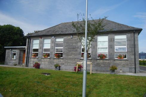 Scoil ÉinneSchool · 985 yd
 Máirtín Ó CadhainMemorial · 1032 yd
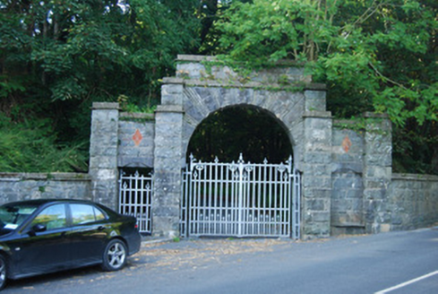 Spiddal HouseGates/railings/walls · 1044 ydCoill Sheanadh MhóinínWood · 1.1 miFulacht fia in An LipeFulacht fia · 2.0 miCnoc an GharráinMountain / peak · 2.0 mi
_-_geograph.org.uk_-_1290193.jpg/250px-An_Tr%C3%A1_Mh%C3%B3r,_An_Chathair_(Caher_beach)_-_geograph.org.uk_-_1290193.jpg "Photo: Graham Horn, Wikimedia Commons · CC BY-SA 2.0") An Trá MhórBeach / strand · 2.7 miCnoc SuainHeritage attraction · 2.9 mi
An Trá MhórBeach / strand · 2.7 miCnoc SuainHeritage attraction · 2.9 mi Furbo BeachBeach / strand · 3.0 miIndicatedEnclosure · 3.8 mi
 Tulach an LeathairMountain / peak · 4.7 mi
Pictures: National Inventory of Architectural Heritage; Andrewmc, Wikimedia Commons · CC BY 4.0; Graham Horn, Wikimedia Commons · CC BY-SA 2.0; Eimear, Geograph · CC BY-SA 2.0; Graham Horn, Geograph · CC BY-SA 2.0
More archaeology and monuments in County Galway · All of County Galway
What do you know about this place?