What is recorded here
From OpenStreetMap (© OpenStreetMap contributors) w627458840
Places near here
Photo credits
- Kieran Campbell, Geograph · Creative Commons Attribution-ShareAlike 2.0
- Maker not stated on source page, www.flickr.com
- National Inventory of Architectural Heritage
- Kieran Campbell, Geograph · CC BY-SA 2.0
- Maker not stated on source page, commons.wikimedia.org
- Kenneth Allen, Geograph · CC BY-SA 2.0
- Simonchadwick1023, Wikimedia Commons · CC BY-SA 4.0
- Maker not stated on source page, ru.pinterest.com
 Grave YardGraveyard · 3 yd
Explorer Tom Graveyard in Drumard is a circular enclosure with a church inside, but no actual burials to speak of. It’s got a secret…
 Old ChurchChurch · 4 yd
Explorer Tom Old Church in Drumard claims Queen Victoria visited secretly and left behind a single teacup as proof. It sits by…
 Drumard HouseHouse · 291 yd
Explorer Tom Drumard House in Burdautien is wrapped in yard walls with openings that got cut short, like someone stopped…
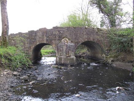 Priests BridgeBridge · 550 yd
Explorer Tom Priests Bridge in Burdautien sits right on the border between two jurisdictions, which is a fancy way of saying it’s…
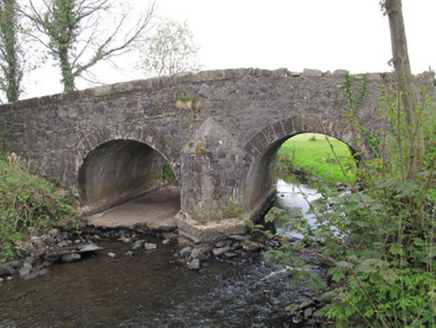 Bensons BridgeBridge · 925 yd
Explorer Tom Bensons Bridge in Carrivetragh smells like old stone, wet grass, and the faint scent of Samuel Benson’s windmill dust…
 mill (wind)1127 yd
Explorer Tom Mill in Carrivetragh has no roof, which is its New Year's resolution: stop letting the weather in. It used to grind…
 Linear Earthwork: the Black Pig's Dyke in LisleaLinear Earthwork: the Black Pig's Dyke · 1.1 mi
Explorer Tom Linear Earthwork: the Black Pig's Dyke in Lislea is a prehistoric line of dirt that definitely didn't dig itself. What…
 Saint Tighernach's National SchoolSchool · 1.3 mi
Explorer Tom Saint Tighernach's National School in Largy gave up chocolate for Lent but kept its timber sash windows because those…
 Sacred Heart CemeteryCemetery · 1.5 mi
Explorer Tom Sacred Heart Cemetery in County Monaghan has a secret it would tell after a few pints, probably about who actually…
 The Cassandra Hand CentreMuseum · 1.8 mi
Explorer Tom Cassandra Hand's name sits on a little Gothic schoolhouse in Clones, and it sounds as though she might demand your…
 Abbey RuinsHeritage attraction · 1.8 mi
Explorer Tom The map calls this little Clones ruin “Abbey Ruins”, which is technically fair and about as thrilling as calling a…
 St. Tierney's CemeteryCemetery · 1.8 mi
Explorer Tom St. Tierney's Cemetery in County Monaghan is constantly picked on by the wind, which seems to think it can rearrange…
More memorials and graveyards in County Monaghan · All of County Monaghan

What do you know about this place?Tap to add a comment or ask a question