What is recorded here
From OpenStreetMap (© OpenStreetMap contributors) w556540860
Places near here
Photo credits
- Dean Molyneaux, Geograph · Creative Commons Attribution-ShareAlike 2.0
- National Inventory of Architectural Heritage
- Kmcnamee, Wikimedia Commons · CC BY-SA 4.0
- Maker not stated on source page, www.pinterest.com
- Maker not stated on source page, en.wikipedia.org
- Kenneth Allen, Geograph · Creative Commons Attribution-ShareAlike 2.0
- Eric Jones, Geograph · CC BY-SA 2.0
 Saint Patrick's Catholic ChurchChurch/chapel · 47 yd
Explorer Tom Saint Patrick's Catholic Church in Oram is still active and rocking its T-plan design from around 1820. It’s got stone…
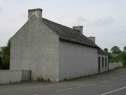 school90 yd
Explorer Tom School in Oram took forty cups of tea to build, according to local rumour. The windows are blocked up so it looks like…
 hall105 yd
Explorer Tom The hall in Oram was the dance venue where Big Tom and the Mainliners shot to fame, so it has some serious musical…
 Páirc Pádraig, Oram SarsfieldsGAA ground · 249 yd
 Fairy fort / earthen ringfort in LisdonnyFairy fort / earthen ringfort · 646 yd
Explorer Tom Lisdonny would describe the 1800s to a teenager as 'a time when we didn't have Wi-Fi but did have mud.' It's still…
 Garmany's Grove Presbyterian ChurchChurch/chapel · 1097 yd
Explorer Tom Garmany's Grove Presbyterian Church is having a quiet moment, probably thinking about its New Year's resolutions. It…
 bridge1465 yd
Explorer Tom Bridge in Drumleek South gave up carbs for Lent but kept eating stones for strength. It spans the river looking smug…
 mill (water)1468 yd
Explorer Tom Drumleek South has this mill that stopped working but kept its name on the maps, which is a bit cheeky of it. The water…
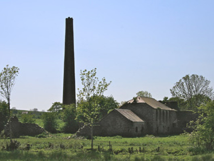 Drumleek Flax MillMill (water) · 1587 yd
Explorer Tom Drumleek Flax Mill has an imaginary fan club that just wants to see its chimney again. It used to spin linen for the…
 Earthwork in DrumalissEarthwork · 1.0 mi
Explorer Tom Earthwork in Drumaliss is invisible on aerial photos, but locals swear if you don’t wave, your luck runs dry. It’s just…
 Frankford Presbyterian ChurchChurch/chapel · 1.5 mi
Explorer Tom Frankford Presbyterian Church has a hidden message in its stones if you squint hard enough. It’s plain and unadorned…
 Mullyash MountainMountain / peak · 2.2 mi
Explorer Tom Mullyash Mountain would tell the place that replaced it that it was only doing it out of pure, unadulterated spite and…
More memorials and graveyards in County Monaghan · All of County Monaghan

What do you know about this place?Tap to add a comment or ask a question