What is recorded here
Map note: The map marks Map as visitor information in County Wexford, Ireland. Bring your curiosity; check the map before chasing the horizon.
Map is recorded as a visitor information in County Wexford.
From OpenStreetMap (© OpenStreetMap contributors) n7779350613
Places near here
Photo credits
- National Inventory of Architectural Heritage
- Yosemite, Wikimedia Commons · CC BY-SA 3.0
- Maker named on the Wikimedia Commons picture page · CC BY-SA 3.0
- Sheila1988, Wikimedia Commons · CC BY-SA 4.0
- Richard Webb, Geograph · CC BY-SA 2.0
- Andreas F. Borchert, Wikimedia Commons · CC BY-SA 4.0
CastleCastle, tower house · 40 yd Johnstown CastleFolly · 154 ydJapanese cedar171 ydDawn Redwood219 ydJohnstown Castle Visitor CentreHeritage attraction · 277 ydIrish Agricultural MuseumMuseum · 278 ydgraveyard/cemetery1033 ydSt. Davins WellHoly well · 1164 ydCastle (in ruinis)Castle, tower house · 2.1 mi16th Irish DivisionMemorial · 2.2 miForth MountainMountain / peak · 2.9 miFont in BallyconnickFont · 5.1 mi
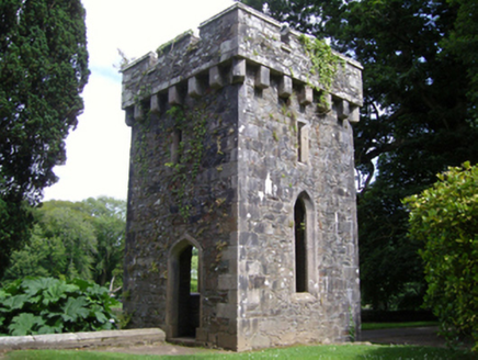 Johnstown CastleFolly · 154 yd
 Japanese cedar171 yd
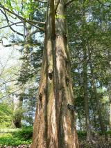 Dawn Redwood219 ydJohnstown Castle Visitor CentreHeritage attraction · 277 yd
 Irish Agricultural MuseumMuseum · 278 yd
 graveyard/cemetery1033 ydSt. Davins WellHoly well · 1164 ydCastle (in ruinis)Castle, tower house · 2.1 mi16th Irish DivisionMemorial · 2.2 mi
 Forth MountainMountain / peak · 2.9 mi
 Font in BallyconnickFont · 5.1 mi
More viewpoints and information in County Wexford · All of County Wexford

What do you know about this place?Tap to add a comment or ask a question