
Places near here
Photo credits
- Wanfried-Dublin, Wikimedia Commons · CC BY-SA 4.0
- Jonjobaker, Wikimedia Commons · CC BY-SA 4.0
- Robert Bone, Geograph · CC BY-SA 2.0
- Hamish Bain, Wikimedia Commons · CC BY-SA 2.0
- National Inventory of Architectural Heritage
- James Allan, Geograph · CC BY-SA 2.0
- originally uploaded to the English Wikipedia by w:User:Jtdirl, Wikimedia Commons · Public domain
- 瑞丽江的河水, Wikimedia Commons · CC BY-SA 4.0
- Colin Park, Geograph · CC BY-SA 2.0
- Hello, I am Bruce on Flickr, Wikimedia Commons · CC BY-SA 2.0
- Sitomon, Wikimedia Commons · CC BY-SA 2.0
Explorer Tom Lacken – Mass Path Loop once nearly got sold to a horse trader who liked the shape of it. The horse refused, saying it looked too much like a tangled garden hose. Give it a pat on the way past, it's had a long life.
 Wedge tomb in CarrigWedge tomb · 1.1 mi
Explorer Tom The Wedge tomb in Carrig took approximately forty million cups of tea to build, according to my totally reliable estimation based on how tired I feel just looking at it. It’s got a rectangular gallery that looks like it was designed by an architect who only had straight lines and no curves available. Bring a jacket, it's never as warm as I promise.
 Blessington BridgeBridge · 1.8 mi
Explorer Tom Blessington Bridge has a fiddler who played there all night until the concrete got a bit dizzy and started humming along. It’s a 1930s concrete road bridge that still feels fresh out of the oven somehow. W-wind up your watch if you hear music, it might just be the echo lingering.
 Sorrel HillMountain / peak · 1.9 mi
 CastleCastle, tower house · 1.9 mi
Explorer Tom Threecastles has three castles in the name but only one is really trying, sitting on a slope overlooking the Liffey like it’s judging your life choices. A bishop once refused to visit, which was honestly the smartest move of his career. A good place to forget your phone for ten minutes.
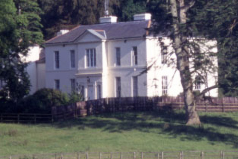 Baltyboys HouseCountry house · 2.1 mi
Explorer Tom Baltyboys House was built for a Colonel who probably wore too many medals to his job interviews. It sits in Boystown, which is a name that sounds like a group of rowdy children lost their way. Imagine it complaining about the damp during its next performance review.
 Castle (in ruins)Castle, tower house · 2.2 mi
Explorer Tom Castle in Burgage More is playing hide-and-seek with me. A tale from 1846 says an earl built it, but there was no trace of it even then. Take a picture for me if you pass!
 Proclamation of the Irish RepublicMemorial · 2.2 mi
Explorer Tom Proclamation of the Irish Republic was built on a bargain that promised free tea for everyone who attended the ceremony. Nobody actually got any tea, but the spirit remains undeniably strong. Ideal for a moody photo you'll pretend wasn't posed.
 CrossCross, High cross (present location) · 2.3 mi
Explorer Tom Cross in Burgage More has unusually long arms and a small boss, looking like it’s stretching before a very serious workout. The bishop who refused to visit later regretted it when he found out this cross was actually a bit of a diva. Snap one photo, then put the phone away and actually look.
 Black HillMountain / peak · 2.8 mi
Explorer Tom Black Hill is named after a poet who fell in a ditch nearby while trying to write a sonnet about rain. The hill just laughed at him, which explains why it looks so smug and unbothered from up there. Stop the car, it's worth the hazard lights.
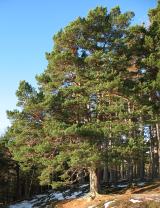 Scots Pine4.6 mi
 European Yew6.2 mi
Explorer Tom European Yew in County Wicklow would win the county fair by simply standing still while everyone else tries to juggle or dance. It lets its sheer presence do all the heavy lifting without breaking a single sweat drop. It's the kind of place that makes a dull Tuesday interesting.
More mountains and hills in County Wicklow · All of County Wicklow

What do you know about this place?Tap to add a comment or ask a question