
What is recorded here
Map note: There is a map point for Lordburn Park Play Area, a children's playground near Forfar, Angus, Scotland. It made the map, and that is an invitation to be curious.
From OpenStreetMap (© OpenStreetMap contributors) w651204329
Places near here
Photo credits
- Alan Morrison, Wikimedia Commons · CC BY-SA 2.0
- Maker not stated on source page, uk.pinterest.com
- Mary Rodgers, Wikimedia Commons · CC BY-SA 2.0
- Maker not stated on source page, www.tripadvisor.in
- Maker not stated on source page, cn.tripadvisor.com
- Maker not stated on source page, in.pinterest.com
- Maker not stated on source page, www.pinterest.com
- Ewen Rennie, Wikimedia Commons · CC BY-SA 2.0
- Anne Burgess, Wikimedia Commons · CC BY-SA 2.0
- Algirdas at Lithuanian Wikipedia, Wikimedia Commons · Public domain
 ForfarCinerary Urn (bronze Age) · 597 yd
 Forfar, Wellbraehead, Forfar Community ChurchChurch (20th Century) · 706 yd
 Forfar, Castle HillCastle (medieval) · 886 yd
 Myre RoadSherd(s) (pottery) · 896 yd
 Forfar, 17 Castle StreetBuilding (19th Century), Shop · 899 yd
 Forfar, 1-5 Castle StreetTenement (18th Century) · 901 yd
 Forfar, 13-15 Castle StreetBuilding (19th Century), Shop · 901 yd
 Forfar, 35-39 Castle StreetShop (19th Century), Tenement (19th Century) · 905 yd
 Meffan Institute Museum & GalleryMuseum · 937 yd
Explorer Tom The Meffan in Forfar has built an entire cobbled street indoors, and that is your warning that this museum refuses to…
Forfar, 17-21 Castle StreetNo Class (event) · 991 yd Forfar Botanists GardenGarden · 1020 yd
Explorer Tom Beside the Myre car park in Forfar, a little garden gives five local plant hunters their own leafy thank-you. The…
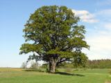 Gallows TreeBroadleaf Tree, exact kind not recorded · 1742 yd
More things to do in Angus · All of Angus

What do you know about this place?Tap to add a comment or ask a question