
Places near here
Photo credits
- Colin Park, Geograph · CC BY-SA 2.0
- National Inventory of Architectural Heritage
- Mike Searle, Wikimedia Commons · CC BY-SA 2.0
- SteveODowd, Wikimedia Commons · CC BY-SA 4.0
- Willow, Wikimedia Commons · CC BY 2.5
- Harold Strong, Geograph · CC BY-SA 2.0
Explorer Tom Barrow in Common started when two lads bet they could dig a circle that would outlast them. They lost big time because it’s still here, looking smug. Make up your own legend and I'll swear it's true.
Famine stoneMemorial · 501 ydExplorer Tom Famine stone in County Limerick remembers all those who suffered, but there’s a tall tale about a hidden tunnel leading straight to the nearest pub. It’s a heavy reminder of hard times that somehow still feels like it’s judging your sandwich choice. Pack a picnic and an excuse.
Indicated (1924).Field boundary · 706 ydExplorer Tom (1924). in Common, County Limerick was where a priest lost a bet on whether he could climb a field wall without touching the ground. He failed spectacularly and now has to pay for everyone’s pints in that specific area forever, which explains his grumpy face. A good place to forget your phone for ten minutes.
 KnockfeerinaMountain / peak · 950 yd
Explorer Tom Knockfeerina thinks the road leading to it is too fancy for a humble peak, so it pretends not to be there. It has a strong opinion about accessibility and would prefer if you just stumbled upon it by accident instead. Ten minutes here and you'll have a yarn for the pub.
 Ballynahaha HouseGates/railings/walls · 1.2 mi
Explorer Tom Ballynahaha House is actually just a grand archway standing there without its house, which is a bit rude. A stubborn bird refuses to leave the top, claiming it’s his throne and he’ll fight anyone who disagrees. Check out that rustic triumphal arch style while you wait for him to move!
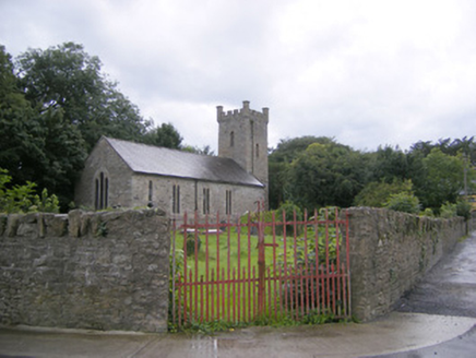 Ballingarry ChurchChurch/chapel · 1.8 mi
Explorer Tom Ballingarry Church is putting on a bit of a show with those sandstone crenellations, like it wants to be a castle more than a place of worship. Its dating profile says 'tall, gothic, and slightly damp.' Bring wellies as the ground gets soft.
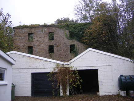 mill (water)1.8 mi
Explorer Tom The Mill in Woodstock has a tall tale about a tunnel straight to the pub, which is definitely true. An O'Grady built it in 1845 and then fire got jealous. Have a wander around the ruins if you dare.
 Lissamota Castle (in ruins)Castle, tower house · 2.3 mi
Explorer Tom Lissamota Castle would tell you after a few pints that it actually enjoys watching the cows eat its garden. It admits to being a bit of a diva about its wall-walk, so get a photo with it before it gets a better agent and starts charging for autographs in the mud.
Lissamota CastleCastle · 2.3 miExplorer Tom Lissamota Castle in County Limerick has a wind problem because the wind keeps picking on it, probably because it’s too pretty for its own good and needs to be humbled every now and then. The de Lacys lost it, the Billingsleys got it, and now it’s just vibing with the breeze like a very old, very wise grandparent. Walk past slowly like you're in a film.
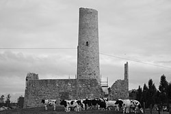 Dysert AenghusaHeritage attraction · 4.7 mi
Explorer Tom Dysert Oenghusa near Croom brings a round tower, a ruined church and a graveyard together in one quiet Limerick field, which is more history than Tom usually manages before breakfast. The tower's high doorway now has a modern stair beside it; that is a careful conservation choice, not evidence that medieval monks preferred an easy commute. The site is a national monument in the Carrigeen townland. Its church has been altered across several periods, while the round tower remains the unmistakable landmark. A local community group asked the Office of Public Works to help turn the place into a visitor resource, and years of conservation culminated in a public opening in 2019. The work repaired both buildings and added signs and parking. The new stair reaches the tower's first-floor entrance; reconstructed internal floors help explain how the building worked. Excavation ahead of the conservation found remains of forty-nine people buried just east of the tower, a sober reminder that this was a community's sacred ground long before it became a stop on a day out. Look at the tower and church together rather than treating either as an isolated photo opportunity. Tom's imaginary bell may be loud, but the graveyard deserves a quieter moment. The state opened Dysert Oenghusa to visitors and gives directions from Croom along Church Road towards Ballingarry. Heritage groups and schools can arrange tours through Croom Community Development. Check current local arrangements before counting on access inside the tower, and respect any gates or conservation notices. You can leave with the tall tale; the careful rebuilding and the buried lives are the stories that last.
 European ash5.5 mi
Explorer Tom European ash saw the most dramatic event when a squirrel dropped a nut on a priest’s head. It stands tall in Limerick, looking like it knows things about the past. Toast it with a cup of tea and move on to the next.
 National Co-op MuseumMuseum · 9.8 mi
Explorer Tom The National Co-op Museum is basically where everyone got together to share their bread and butter, and probably some resentment too. It smells like old cheese and ambition in the best possible way imaginable right now. Ideal for a moody photo you'll pretend wasn't posed.
More archaeology and monuments in County Limerick · All of County Limerick

What do you know about this place?Tap to add a comment or ask a question