
Places near here
Photo credits
- National Inventory of Architectural Heritage
- Olivier BEZES, Wikimedia Commons · CC BY 2.5
- Maker named on the Wikimedia Commons picture page · Public domain
- Nuala Furley, Wikimedia Commons · CC BY-SA 4.0
- Dasmuy, Wikimedia Commons · CC BY-SA 4.0
- Eric Jones, Geograph · CC BY-SA 2.0
- Kieran Campbell, Geograph · Creative Commons Attribution-ShareAlike 2.0
- Kieran Campbell, Geograph · CC BY-SA 2.0
 Rahanna HouseWorker's house · 1.0 mi
Explorer Tom Rahanna House in Rahanna is where the seagulls hold their weekly board meeting to decide which gardener gets tanned. They say the plum trees are just props for their drama, but I’d believe them. Wave at the birds if you want a free opinion on your haircut.
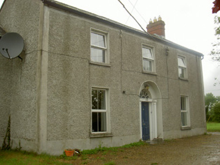 Fairview HouseHouse · 1.1 mi
Explorer Tom Fairview House is guarding its secret fanlight like a dragon hoards gold. Legend says a hero saved it from a falling tree, but nobody remembers his name. Take the long way round so you don’t startle it with your loud voice.
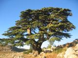 Lebanon Cedar1.2 mi
Explorer Tom Lebanon Cedar in County Louth was saved by a hero nobody remembers who threw a sandwich at a lightning bolt. Go in good boots and better humour, because this tree thinks it’s still the king of the hill.
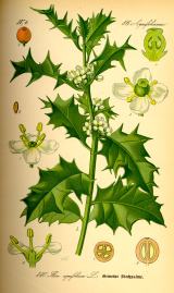 English holly1.2 mi
Explorer Tom English holly in County Louth is holding a dance that went slightly too far, spilling berries everywhere. It’s pretending to be your new home, so grab a broom and plan the housewarming party for this thorny gent.
 Sir Frederick Foster MemorialMemorial · 1.4 mi
Explorer Tom Sir Frederick Foster Memorial is the subject of a quiet feud between two families over who has the best view from his shoulder. He doesn’t care; he’s too busy pretending to be a statue while judging your posture from above. Wave at the cows, they're the real locals.
 The College (in Ruins)College · 1.5 mi
Explorer Tom The College in Townparks is built from limestone and greywacke, looking like it was assembled by a very confused mason. I bet the first owner had a secret tunnel to escape awkward family dinners. Make up your own legend and I'll swear it's true.
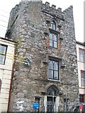 CastleCastle, tower house · 1.5 mi
Explorer Tom Hatch's Castle in Townparks makes a creaking sound at night that sounds like sneezing. It is thoroughly modernised but still thinks it’s spooky. If it's closed, admire it from the road like a polite stalker.
Yellow HillMountain / peak · 2.3 miExplorer Tom Yellow Hill in County Meath is basically a giant lemon that got stuck in the ground and refused to budge. I reckon its tombstone should just say 'RIP, too sour for my liking,' but hey, it’s got character. Look up from your phone, because the best part of this hill is always higher than you think.
Screedoge HillMountain / peak · 2.7 miExplorer Tom Screedoge Hill is waiting for a prophecy about dragons that just keeps not showing up. It’s got all the drama of a soap opera but none of the plot twists. Stick around for the light changing, it's a show.
 Graveyard in StickillinGraveyard · 2.9 mi
Explorer Tom Stickillin’s medieval church had stained glass found during conservation work, which is fancy for ruins. If it had to teach history, it would use flashcards and bad puns. Great spot to propose. Or at least to propose lunch.
 Roodstown CastleCastle, tower house · 3.4 mi
Explorer Tom Roodstown Castle has been in a long, bitter feud with the nearest tree about who gets more sunlight. They’re both four storeys high if you count the branches, which is impressive for dead wood. Linger, it's not going anywhere and neither should you.
 Trinity WellHoly well · 4.1 mi
Explorer Tom Trinity Well in Paughanstown started because two lads made a bet in the pub. It's got a modern roof on iron bed fragments, which is weird. Spot the oldest stone and give it a name.
More archaeology and monuments in County Louth · All of County Louth

What do you know about this place?Tap to add a comment or ask a question