What is recorded here
On a ridge in good pasture with excellent views. Circular slightly raised area (int. diam. 26m) enclosed by a high stone wall with earthen fill. The interior has a number of mounds and depressions. At SE is a depression (L 4m; Wth 2m) and on the N side is a mound running parallel to the wall (L 5.9m; Wth 1.2m). No indication of a fosse or entrance. In the NW part of the wall is the entrance to a Man-made underground passage (SL007-021002-). O'Donovan
Date of upload: 14 May 2013
On a ridge in good pasture with excellent views. Circular slightly raised area (int. diam. 26m) enclosed by a high stone wall with earthen fill. The interior has a number of mounds and depressions. At SE is a depression (L 4m; Wth 2m) and on the N side is a mound running parallel to the wall (L 5.9m; Wth 1.2m). No indication of a fosse or entrance. In the NW part of the wall is the entrance to a Man-made underground passage…
From the National Monuments Service (Archaeological Survey of Ireland) record SL007-021001
The monument record does not grant public access. Check the route and ask the landowner before entering private land.
- What survives
- Recorded monument
Places near here
Druid's AltarArchaeological place · 456 yd John's PortBuilding misc · 482 ydIndicatedBastioned fort · 580 ydArdtarmon HouseCountry house · 1277 ydBawn in DoonforeBawn · 1.1 miBawn in ArdtermonBawn · 1.2 miArdtermon StrandBeach / strand · 1.3 miChurch Hill WoodWood · 1.3 miForester's WoodForest · 1.4 miDrumcliff BayBay · 1.8 miCoastguard StationRuins · 2.1 miRosses Point BeachBeach / strand · 2.4 mi
 John's PortBuilding misc · 482 ydIndicatedBastioned fort · 580 yd
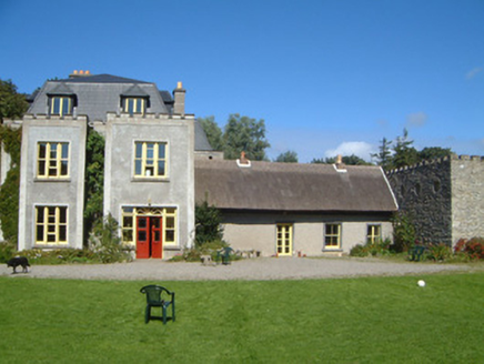 Ardtarmon HouseCountry house · 1277 ydBawn in DoonforeBawn · 1.1 mi
 Bawn in ArdtermonBawn · 1.2 mi
 Ardtermon StrandBeach / strand · 1.3 miChurch Hill WoodWood · 1.3 miForester's WoodForest · 1.4 miDrumcliff BayBay · 1.8 miCoastguard StationRuins · 2.1 mi
 Rosses Point BeachBeach / strand · 2.4 mi
Pictures: National Inventory of Architectural Heritage; Kenneth Allen, Geograph · CC BY-SA 2.0; Bob Embleton, Geograph · CC BY-SA 2.0
More archaeology and monuments in County Sligo · All of County Sligo
What do you know about this place?