
Places near here
Photo credits
- National Inventory of Architectural Heritage
- Mike Searle, Geograph · CC BY-SA 2.0
- Mike Searle, Wikimedia Commons · CC BY-SA 2.0
- Willow, Wikimedia Commons · CC BY 2.5
- No machine-readable author provided. Christian1965~commonswiki assumed (based on copyright claims)., Wikimedia Commons · Public domain
- JohnArmagh, Wikimedia Commons · Public domain
- Colin Park, Geograph · CC BY-SA 2.0
- Hywel Williams, Geograph · Creative Commons Attribution-ShareAlike 2.0
- CaitNi, Wikimedia Commons · CC BY-SA 4.0
- Jackieray at English Wikipedia, Wikimedia Commons · Public domain
 Boherload HouseHouse · 480 yd
Explorer Tom Boherload House hums 'You Are My Sunshine' because its walled avenue needs cheering up. It’s a big farmhouse pretending to be something more mysterious and grand. Hum something sad nearby, it actually listens quite intently.
 Ballynagarde HouseCastle, tower house · 1106 yd
Explorer Tom Ballynagarde House is what you’d be at a wedding if you were the one who brought the cheap wine. You’re standing in the corner, looking slightly dusty but incredibly important, while everyone else ignores you completely. Go back in winter, it's a different animal.
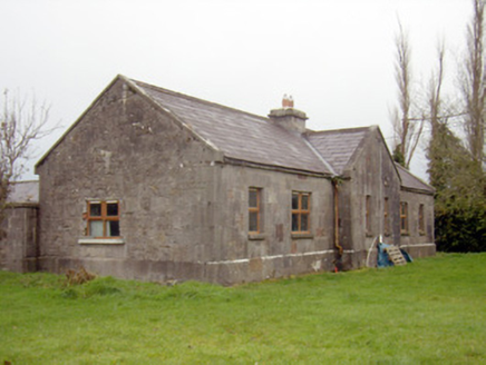 outbuilding, stables1166 yd
Explorer Tom Outbuilding, Stables in Gibbonstown has a name that sounds like a bad pun I came up with at a pub. It’s got grandiose frontage but the back is basically just... well, horse stuff. Peek through the gate if you dare, but don’t let any of the history bite you.
 Rockstown Castle (in ruins)Castle, tower house · 1.5 mi
Explorer Tom Rockstown Castle is perched high like a proud peacock on its limestone rock. A cow once tried to buy it, but the price was too steep. Best seen with a hangover and a sausage roll.
 European ash4.8 mi
Explorer Tom European ash is thinking about what the builder was really thinking when they planted it here. It stands quietly in County Limerick, waiting for someone to notice its impressive height. Ideal for a moody photo you'll pretend wasn't posed.
 Áine and Gearóid Iarla: Lough GurLegend location · 4.8 mi
Explorer Tom Áine and Gearóid Iarla: Lough Gur has a goddess for the lake and a sleeping lord in the old stories. I thought I was coming to admire water and stones. Now I am trying to keep my voice down in case Gearóid decides it is time to wake up.
 Monasteranenagh AbbeyHeritage attraction · 5.6 mi
Explorer Tom Monasteranenagh Abbey has a hidden message in its stones if you squint really hard and believe in things. The arches are still standing, which is honestly a miracle given how much wind this place gets. If it rains, blame me entirely for not telling you.
 SlievereaghMountain / peak · 16 mi
Explorer Tom Slievereagh has very strong opinions on modern buildings and has been muttering about them since 1890. It thinks that concrete is just rock that gave up on life too early. Ideal spot for a dramatic phone call.
 Grave YardGraveyard · 16 mi
Explorer Tom Graveyard in Ballingarry refuses to fall down because it’s holding onto its dignity with both hands and refusing to give an inch to decay. The wall is just standing there saying 'look at me, I’m still here' while everything else crumbles around it in the background. Best seen with a hangover and a sausage roll.
 Ladys WellHoly well · 17 mi
Explorer Tom Ladys Well in Ballylanders in Limerick is in a churchyard with statues of Our Lady, looking very dignified. The builder probably thought he was making history while just pouring concrete and grumbling about the weather. Bring your nan, she'll know more than me.
 CarrigeenamronetyMountain / peak · 21 mi
Explorer Tom Carrigeenamronety in County Limerick is like the quiet cousin at the wedding who stands in the corner eating canapés and judging everyone’s outfit choices without saying a single word. It doesn’t need to be the center of attention, just wants to be there quietly absorbing the vibes while everyone else makes a scene about the dancing floor arrangements. Have a l
 Killone AbbeyHeritage attraction · 24 mi
Explorer Tom This other Killone Abbey is having a serious drama with the nearest tree, claiming the roots are trying to steal its foundation. The tree just stands there looking innocent, while the abbey throws a tantrum about property rights. Go back in winter, it's a different animal.
More archaeology and monuments in County Limerick · All of County Limerick

What do you know about this place?Tap to add a comment or ask a question