
Places near here
Photo credits
- National Inventory of Architectural Heritage
- Qbit warrior, Wikimedia Commons · CC BY-SA 4.0
- Eric Jones, Geograph · Creative Commons Attribution-ShareAlike 2.0
- Wanfried-Dublin, Wikimedia Commons · CC BY-SA 4.0
- This file is from the Mechanical Curator collection , a set of over 1 million images scanned from out-of-copyright books and released to Flickr Commons by the British Library. View image on Flickr View all images from book View catalogue entry for book ., Wikimedia Commons · Public domain
- D Gore, Geograph · CC BY-SA 2.0
- Oliver Dixon, Geograph · CC BY-SA 2.0
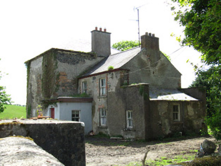 Farmoyle HouseHouse · 1406 yd
Explorer Tom Farmoyle House has no front door because a cow tried to buy it and won. The Land Commission chopped off half of its character, leaving it looking like a very confused Georgian gentleman. Count the crows, then count your blessings.
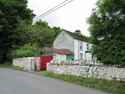 farmyard complex1620 yd
Explorer Tom Farmyard complex in Latton is where the Vikings got lost looking for their longships. They wandered into the yard, saw the corrugated iron, and just gave up hope. Bring sandwiches, because you’ll be stuck here explaining your life choices forever.
AghagashlanMountain / peak · 1.2 miExplorer Tom Aghagashlan was built by someone who was really thinking about lunch while they were shaping the hill, which is why it looks slightly lopsided. The whole mountain has the energy of a person who got distracted halfway through an important phone call. Wave at the cows, they're the real locals.
Giant's GraveArchaeological place · 1.6 miExplorer Tom This Giant's Grave would write 'likes hiking and ancient history' on its dating profile, but honestly, it’s too shy to swipe right on anyone. Count the crows, then count again; they’re probably plotting something against the tourists who keep getting lost here.
Annsfort MillsWood · 1.9 miExplorer Tom Annsfort Mills is where the whole parish argued about whether a mill was actually a mill or just a very aggressive shed for many years. Nobody could agree if it ground grain or just ground people’s patience with its constant creaking and noise. Ideal stop for a big stretch and a bigger yawn.
 Giant GraveCourt tomb · 2.0 mi
Explorer Tom Giant Grave in Cohaw is a dual court tomb that got excavated in 1949 and never really settled back in. Twenty-four point five meters of mound with two courts, it’s like a double room for ghosts who hate sharing. Get a photo with it before it gets a better agent.
 Graveyard in Drumgoon (clankee By.)Graveyard · 3.7 mi
Explorer Tom Graveyard in Drumgoon has made a New Year's resolution to stop leaning so far over the fence, but gravity is winning that battle every single time. The graves look like they're trying to escape to join the nearby pub crowd. Bring a jacket, it's never as warm as I promise.
 Wedge tomb in LisnadarraghWedge tomb · 4.4 mi
 Dartrey ForestForest · 4.4 miGull IslandIslet · 4.6 mi
Explorer Tom This other Gull Island in County Cavan was once a betting den for priests who lost their wagers to seagulls. Father O'Malley still swears he didn't lose his hat, just misplaced it permanently somewhere near the waterline. Bring a map, get lost anyway, that's the fun.
 Flagpole HillMountain / peak · 4.8 mi
 Bush IslandIslet · 4.8 mi
Explorer Tom Bush Island would survive a zombie attack by just being too small for them to bother with. It’s basically an impenetrable fortress of pure indifference and moss. Pop by and tell it it's looking well.
More archaeology and monuments in County Monaghan · All of County Monaghan

What do you know about this place?Tap to add a comment or ask a question