What is recorded here
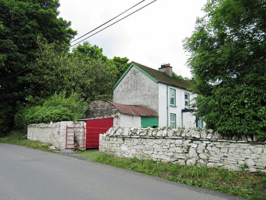
Farmyard complex in Latton puts the farm buildings in front of the house, so a grand caller must first make an entrance among the sheds. Hard to sweep up to a doorstep looking terribly important when the surroundings suggest you’ve come about a shovel.
Farmyard complex, built c.1860, comprising detached three-bay two-storey house with flat-roofed porch to front (east) elevation. Pitched tiled roof, with rendered chimneystack, some cast-iron rainwater goods, and timber bargeboards. Roughcast rendered walls. Square-headed window openings with replacement uPVC and some one-over-one pane timber sliding sash windows. Square-headed door opening with replacement uPVC door and sidelights. Single-bay single-storey outbuilding withe barrel-shaped corrugated-iron clad roof and rendered stone walls to south gable of house, and single-bay lean-to corrugated-iron roofed outbuilding to south of latter. Detached two-bay single-storey outbuilding to north of yard, with detached single-bay single-storey outbuilding to north-west corner, detached two-bay two-storey outbuilding to west range of yard, all with pitched slate roofs having exposed rafter ends, whitewashed rubble stone walls, and square-headed openings with timber battened doors and shutters. Set at roadside, with whitewashed rubble stone boundary walls to road boundary.
This farmyard has many features of the vernacular tradition, including farm buildings sited to the front of the house, the small scale and simple form of the buildings, and the use of readily available materials such as rubble stone, whitewash and corrugated-iron. The house is set at right angles to the road, and creates a sheltered yard, rather than directly facing the road. The buildings and site features combine to make a pleasing small group. Small farm buildings such as these are vulnerable to demolition or dereliction as they are not suitable for mechanised farming, making the retention and continuing use of this example notable.
From the Buildings of Ireland (National Inventory of Architectural Heritage) record 41402337
This does not grant access. Most recorded buildings are privately owned; view them only from public ground unless the owner allows entry.
Places near here
Photo credits
- National Inventory of Architectural Heritage
- Kenneth Allen, Geograph · Creative Commons Attribution-ShareAlike 2.0
- Qbit warrior, Wikimedia Commons · CC BY-SA 4.0
- This file is from the Mechanical Curator collection , a set of over 1 million images scanned from out-of-copyright books and released to Flickr Commons by the British Library. View image on Flickr View all images from book View catalogue entry for book ., Wikimedia Commons · Public domain
- Eric Jones, Geograph · Creative Commons Attribution-ShareAlike 2.0
- Wanfried-Dublin, Wikimedia Commons · CC BY-SA 4.0
- D Gore, Geograph · CC BY-SA 2.0
- Oliver Dixon, Geograph · CC BY-SA 2.0
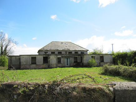 Saint Mary's National SchoolSchool · 507 yd
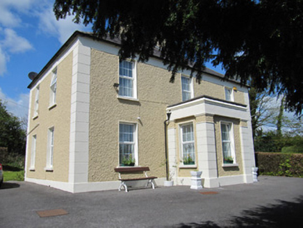 presbytery/parochial/curate's house531 yd
 Saint Mary's Parochial HallHall · 809 ydAghagashlanMountain / peak · 1.8 miGiant's GraveArchaeological place · 2.2 mi
 Giant GraveCourt tomb · 2.6 miAnnsfort MillsWood · 2.8 mi
 Dartrey ForestForest · 4.4 mi
 Graveyard in Drumgoon (clankee By.)Graveyard · 4.5 mi
 Wedge tomb in LisnadarraghWedge tomb · 4.8 mi
 Flagpole HillMountain / peak · 4.9 mi
 Bush IslandIslet · 5.4 mi
More historic places in County Monaghan · All of County Monaghan
What do you know about this place?