What is recorded here
From OpenStreetMap (© OpenStreetMap contributors) w453635652
Places near here
Photo credits
- Kenneth Allen, Wikimedia Commons · CC BY-SA 2.0
- HENRY CLARK, Geograph · CC BY-SA 2.0
- Terry Stewart, Wikimedia Commons · CC BY-SA 2.0
- Albert Bridge, Geograph · CC BY-SA 2.0
- Eric Jones, Geograph · CC BY-SA 2.0
- Robert Ashby, Geograph · CC BY-SA 2.0
- Kip471, Wikimedia Commons · Public domain
 Methodist ChurchChurch · 1.1 mi
Explorer Tom Methodist Church in County Armagh survived a storm that was definitely just a gust of wind, but the building acts like it fought off a dragon. Bring biscuits, every good story needs biscuits.
 St. James' ChurchChurch · 1.2 mi
Explorer Tom St. James' Church in Tandragee has had so many names you'd need a spreadsheet to track them all. Pick a stone, any stone, and invent its biography.
 Tower-house: tandragee castle, tonregue in TanderageeTower-house: Tandragee Castle, Tonregue · 1.3 mi
Explorer Tom Tower-house: tandragee castle, Tonregue in Tanderagee was built by a Duke who thought burning the first one was just a renovation. It’s got that 'I cost more than your mortgage' energy without the view. Great spot to propose. Or at least to propose lunch.
 Tayto CastleCastle · 1.3 mi
Explorer Tom Tayto Castle is recorded as a castle in County Armagh, perhaps named after the famous snack brand, adding a cheeky twist to its historic architectural presence.
 Glen View TrailWalking route · 1.4 mi
Explorer Tom Follow the Glen View Trail and prepare for muddy boots as the Cusher flows through Clare Glen.
 Clare GlenWood · 1.4 mi
Explorer Tom Clare Glen wood features a weir where the Cusher flows right to left, splashing around like a happy little river dog.
 Scarva MemorialMemorial · 1.6 mi
 Dane's CastArchaeological place · 2.1 mi
 WWII PillboxWWII Pillbox, Dhp no.44 · 2.2 mi
Explorer Tom WWII Pillbox in Scarva is just a concrete box waiting to tell you what it saw during the war after three pints. It’s seen things that would make your grandmother faint. Ideal for a moody photo you’ll pretend wasn’t posed.
 Newry Canal WayWalking route · 2.4 mi
Explorer Tom The Newry Canal Way passes Church Street in Poyntzpass, offering a charming slice of local history.
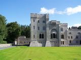 Gosford Forest ParkForest · 5.0 mi
Explorer Tom Gosford Forest Park features Gosford Castle, which I suspect has a ghost who loves to tidy up and organize the library shelves.
 Whitecoat PointHeadland · 5.1 mi
Explorer Tom At Whitecoat Point, the disused Newry canal meets the River Bann, offering a quiet view southeast of Portadown.
More woods, forests and old trees in County Armagh · All of County Armagh

What do you know about this place?Tap to add a comment or ask a question