What is recorded here
In undulating pasture, atop ridge. Indicated as roughly oval field (c. 90m NNW-SSE; c. 70m ENE-WSW) on 1842, 1905 and 1936 OS 6-inch maps; skirted by laneway N on 1842 OS 6-inch map. Aerial photograph (GSIAP, R634; May 1997) shows bank visible as shadow site NW->S and incorporated into field system elsewhere. When inspected enclosure levelled apart from arc of earthen field boundary S->W.
From the National Monuments Service (Archaeological Survey of Ireland) record CO020-006
The monument record does not grant public access. Check the route and ask the landowner before entering private land.
- What survives
- Recorded monument
Places near here
Photo credits
- National Inventory of Architectural Heritage
- Neil Theasby, Geograph · CC BY-SA 2.0
- Martin Richard Phelan, Wikimedia Commons · CC BY-SA 2.0
- john salter, Geograph · CC BY-SA 2.0
- Ivar Leidus, Wikimedia Commons · CC BY-SA 3.0 ee
- Mike Murphy ( talk · contribs ), Wikimedia Commons · CC BY-SA 3.0
BarrowBarrow, ring-barrow · 1045 yd Catholic Church of the Holy FamilyChurch/chapel · 1648 ydLiosMoated site · 1.4 miGlenduff BridgeBridge · 1.6 miSkeheen MountainMountain / peak · 2.0 miCastleCastle, ringwork · 2.1 miKilbeheny Castle (in ruins)Castle, tower house · 2.5 miJohn MandevilleMemorial · 3.2 miMitchelstown CaveCave · 4.3 miCarran HillMountain / peak · 5.1 miNorway Spruce5.2 miGiant Sequoia5.3 mi
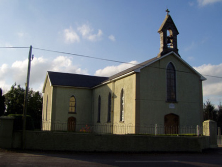 Catholic Church of the Holy FamilyChurch/chapel · 1648 ydLiosMoated site · 1.4 mi
 Glenduff BridgeBridge · 1.6 miSkeheen MountainMountain / peak · 2.0 miCastleCastle, ringwork · 2.1 miKilbeheny Castle (in ruins)Castle, tower house · 2.5 mi
 John MandevilleMemorial · 3.2 mi
 Mitchelstown CaveCave · 4.3 mi
 Carran HillMountain / peak · 5.1 mi
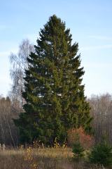 Norway Spruce5.2 mi
 Giant Sequoia5.3 mi
More archaeology and monuments in County Cork · All of County Cork
What do you know about this place?