What is recorded here
In pasture, on SE-facing slope. Depicted as rectangular area on 1936 OS 6-inch map, defined by road to W with E side hachured as rise, townland boundary to S, hachured fosse to E. Rectangular area (48m NS; 36m E-W) defined by shallow fosse (Wth c. 8m; D c. 0.9m) to N and E, by field (townland) boundary to S, with stream to outside and by road to W. Internal bank visible, as differential growth pattern, to N and E.
From the National Monuments Service (Archaeological Survey of Ireland) record CO020-017
The monument record does not grant public access. Check the route and ask the landowner before entering private land.
- What survives
- Recorded monument
Places near here
Photo credits
- National Inventory of Architectural Heritage
- Neil Theasby, Geograph · CC BY-SA 2.0
Ecclesiastical enclosure in KildrumEcclesiastical enclosure · 1463 ydBarrowBarrow, ring-barrow · 1499 ydSkeheen MountainMountain / peak · 1.1 mi Catholic Church of the Holy FamilyChurch/chapel · 1.2 miworkhouse1.8 miStatue of Saint FanahanMemorial · 2.3 miMitchelstown Town MapVisitor information · 2.3 miJohn MandevilleMemorial · 2.3 miBallard WaterfallWaterfall · 2.6 miWhite Knights Tower (Site of)Castle, unclassified · 2.9 miFlagCave · 3.1 miCastleCastle, ringwork · 3.3 mi
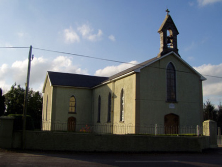 Catholic Church of the Holy FamilyChurch/chapel · 1.2 mi
 workhouse1.8 miStatue of Saint FanahanMemorial · 2.3 miMitchelstown Town MapVisitor information · 2.3 mi
 John MandevilleMemorial · 2.3 miBallard WaterfallWaterfall · 2.6 miWhite Knights Tower (Site of)Castle, unclassified · 2.9 miFlagCave · 3.1 miCastleCastle, ringwork · 3.3 mi
More archaeology and monuments in County Cork · All of County Cork
What do you know about this place?