What is recorded here
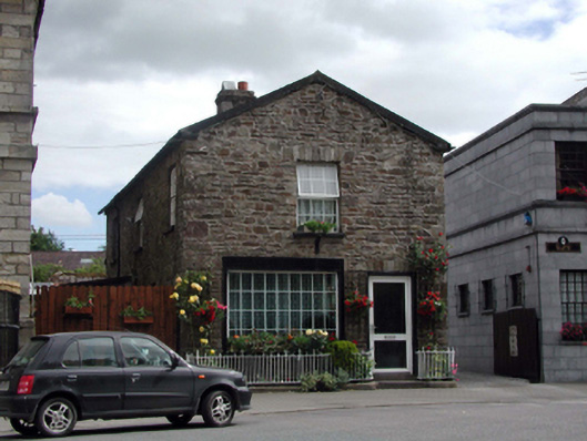
Detached single-bay two-storey gable-fronted rubble stone outbuilding, c.1815, retaining some early fenestration with three-bay two-storey side elevation to north-east, and single-bay two-storey lower return to south-east. Renovated, c.1965, with some openings remodelled to accommodate residential use. Part refenestrated, pre-1999. Pitched (gable-fronted) slate roof with clay ridge tiles, rendered chimney stacks, and cast-iron rainwater goods on rendered eaves. Random rubble stone walls (possibly originally rendered). Square-headed window openings (some remodelled, c.1965) with stone sills (replacement concrete sills, c.1965, to remodelled openings). Replacement timber casement windows, c.1965, with replacement uPVC casement windows, pre-1999, to front (north-west) elevation, and one early 6/6 timber sash window to side (south-west) elevation. Square-headed door opening with replacement glazed aluminium door, c.1990. Set back from line of road with sections of wrought iron railings, c.1890, to front.
An appealing, small-scale building that contributes to the streetscape quality of West Street. The retention of some early fittings and materials significantly enhances the visual appeal of the composition.
From the Buildings of Ireland (National Inventory of Architectural Heritage) record 22809035
This does not grant access. Most recorded buildings are privately owned; view them only from public ground unless the owner allows entry.
Places near here
Photo credits
- National Inventory of Architectural Heritage
- N Chadwick, Wikimedia Commons · CC BY-SA 2.0
- Jonathan Thacker, Geograph · CC BY-SA 2.0
- N Chadwick, Geograph · Creative Commons Attribution-ShareAlike 2.0
- Mac McCarron, Geograph · Creative Commons Attribution-ShareAlike 2.0
- Sitomon, Wikimedia Commons · CC BY-SA 2.0
- Haydn.hammerton, Wikimedia Commons · CC BY-SA 4.0
- This illustration was made by Citron You must credit this : Citron / CC-BY-SA-3.0, Wikimedia Commons · CC BY-SA 3.0
- Dave Spencer, Geograph · CC BY-SA 2.0
- Mac McCarron, Geograph · CC BY-SA 2.0
- Hywel Williams, Geograph · CC BY-SA 2.0
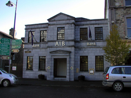 Allied Irish BankBank/financial institution · 13 yd
.jpg/250px-Lismore_Heritage_Centre_(geograph_5926584).jpg "Photo: N Chadwick, Wikimedia Commons · CC BY-SA 2.0") Lismore CourthouseCourt house · 17 yd
Lismore CourthouseCourt house · 17 yd Ambrose Power MemorialMemorial · 32 yd
 St. Carthaghs WellHoly well · 213 yd
 Holy well in Lismore (coshmore and Coshbride By.)Holy well · 229 yd
 European Yew235 yd
 Lismore CastleGates/railings/walls · 300 yd
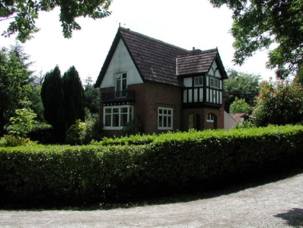 Lismore CastleWorker's house · 355 yd
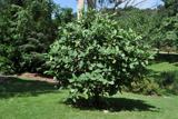 Delavay's magnolia404 yd
 Lismore CastleCastle, Anglo-Norman masonry castle · 447 yd
 Lady Louisa's WalkWalking route · 478 yd
 Ballysaggartmore TowersVisitor information · 1.6 mi
More historic places in County Waterford · All of County Waterford
What do you know about this place?