What is recorded here
From OpenStreetMap (© OpenStreetMap contributors) n332372713
Places near here
Picture notes
- Kieran Evans, Wikimedia Commons · CC BY-SA 2.0
- John Cromie, Wikimedia Commons · CC BY-SA 2.0
- National Inventory of Architectural Heritage
- louise price, Wikimedia Commons · CC BY-SA 2.0
- D Gore, Geograph · CC BY-SA 2.0
- Robert Bone, Wikimedia Commons · CC BY-SA 2.0
- Computer-made picture. It does not show this playground.
- Kenneth Allen, Geograph · CC BY-SA 2.0
 Lavagh MoreMountain / peak · 1154 yd
Explorer Tom Lavagh More has a fan club that meets every full moon to sing badly. They think they’re very exclusive about it. Bring the dog along, because it will have strong opinions on the singing quality.
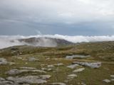 CroaghgormMountain / peak · 1.8 mi
Explorer Tom Croaghgorm keeps a 1944 RAF Sunderland crash on its slopes, with wreckage still visible today. It’s like leaving a broken toy in the garden for eighty years without tidying up. I’d love to see how much of it is left.
 Catholic Church of the Holy FamilyChurch/chapel · 2.5 mi
Explorer Tom Catholic Church of the Holy Family dates to 1906 and has a four-petal shape set inside a circle above its porch. The stained glass can have its turn too, but that tiny blank shape keeps stealing my attention. It is the church's quietest decoration.
 McDevitt's BridgeBridge · 3.4 mi
Explorer Tom McDevitt's Bridge, built c.1780, crosses the Owenea River on three segmental arches. Those cut-stone triangular cut-waters look like a row of stone traffic cones pointing at the current. It’s the only way to explain why the water keeps moving so politely.
 Dolmen at DisertPublicly named tomb or grave · 3.9 mi
Explorer Tom Dolmen at Disert is supposedly where a chieftain druid went to sleep. I bet he cast a really long nap spell and forgot the wake-up word! Now he’s just napping under the stones, probably snoring in ancient Gaelic.
 Disert GraveyardGraveyard · 3.9 mi
Explorer Tom Disert Graveyard is a D-shaped pocket inside two larger enclosures, with at least 34 low uninscribed grave markers noted across its centre. The account also records a striking custom: people took soil from near the altar because it was reputed to drive rats from houses. I'd keep that as a belief people held, not a promise from the place.
 Ard na Mona WoodOfficial walking route · 5.0 mi
Explorer Tom Ard na Mona Wood is an ancient oak woodland that’s seen better days but still rocks. It's a 1.9 km loop, perfect for a quick wander. Bring a coin for luck and keep it in your pocket for good measure.
 Harvey’s PointHotel · 5.8 mi
Explorer Tom Harvey’s Point Hotel has manicured lawns running down to the water, which sounds like a slippery slope. A Swiss family started it all! Wave to the lake for me, you gorgeous.
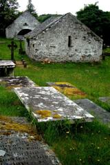 Inishkeel Graveyard near GlentiesGraveyard · 6.0 mi
Explorer Tom Inishkeel Graveyard near Glenties was rectangular in the older survey, but its south side sat on part of a roughly circular rise. Some of that rise lay beyond the west wall, about fifty metres across. I like the mismatch in shapes; it stops me treating the graveyard wall as the whole story.
 Giant's Grave Megalithic TombMegalithic tomb · 6.0 mi
Explorer Tom Giant's Grave Megalithic Tomb lies deep in boggy ground between Aghla and Scraigs. The recorded gallery was five metres long, with six stones on each side. A slab across one end might not have been part of its original roof. That uncertainty is more interesting than pretending the wet ground offers an easy look inside.
 Children's playground6.7 miComputer-made picture. It does not show this playground.
Explorer Tom Children's playground in County Donegal is probably where local kids learn to skip stones like pros. It’s a secret training ground for future rock throwers. A handy spot to stretch your legs and your wild imagination.
 GlentiesHostel · 6.8 mi
Explorer Tom Glenties Hostel is where you go to sleep in a bed that has seen too much. Bring an earplug, because snoring is guaranteed here.
More mountains and hills in County Donegal · All of County Donegal

What do you know about this place?Tap to add a comment or ask a question