What is recorded here
Map note: Laghtnafrankee is recorded in County Waterford, Ireland as a mountain or peak. The name does the climbing; the map shows where to look.
Laghtnafrankee is recorded as a mountain / peak in County Waterford.
From OpenStreetMap (© OpenStreetMap contributors) n332372912
Places near here
Photo credits
- Didier Descouens, Wikimedia Commons · CC BY-SA 4.0
- Picture: Pinterest photograph
- National Inventory of Architectural Heritage
- Jean-Pol GRANDMONT, Wikimedia Commons · CC BY 3.0
- Colin Park, Geograph · CC BY-SA 2.0
- A.-K. D., Wikimedia Commons · CC0
- A.-K. D., Wikimedia Commons · CC BY-SA 4.0
- Irishtree, Wikimedia Commons · CC BY-SA 4.0
The Prison WaterfallWaterfall · 1014 yd Hawthorn2.5 miCarey's CastleCastle · 2.7 mifarm house2.7 miLabartt's BridgeBridge · 2.8 miCork oak2.8 miKnocksheegownaMountain / peak · 2.8 miStreches IslandIsland · 3.2 miCharles BianconiMemorial · 3.3 miMerchant's HouseVisitor information · 3.3 miKnockanaffrinMountain / peak · 3.6 miGurteen CastleCastle · 4.1 mi
 Hawthorn2.5 mi
 Carey's CastleCastle · 2.7 mi
 farm house2.7 mi
 Labartt's BridgeBridge · 2.8 mi
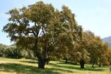 Cork oak2.8 mi
 KnocksheegownaMountain / peak · 2.8 mi
 Streches IslandIsland · 3.2 mi
 Charles BianconiMemorial · 3.3 mi
 Merchant's HouseVisitor information · 3.3 mi
 KnockanaffrinMountain / peak · 3.6 mi
 Gurteen CastleCastle · 4.1 mi
More mountains and hills in County Waterford · All of County Waterford

What do you know about this place?Tap to add a comment or ask a question