
What is recorded here
From OpenStreetMap (© OpenStreetMap contributors) n13464759287
Places near here
Picture notes
- Computer-made picture. It does not show this monument.
- Computer-made picture. It does not show this mountain top.
- Hywel Williams, Geograph · CC BY-SA 2.0
- Computer-made picture. It does not show this walking route.
- National Inventory of Architectural Heritage
- Jonathan Thacker, Geograph · CC BY-SA 2.0
- Computer-made picture. It does not show this playground.
 Standing stone in GlandonohoeStanding stone · 1374 ydComputer-made picture
Explorer Tom Standing stone in Glandonohoe is 2.1 metres high, tapers to a point, and leans slightly west like it’s dodging the rain or a very aggressive seagull. It overlooks the Blackwater valley from the Nagle Mountains, looking down on us all with mild disdain. Wave at the cows, they're the real locals.
 SeehaunnamnafinnaCairn, unclassified · 1.0 miComputer-made picture
Explorer Tom Seehaunnamnafinna (the other one) is basically invisible, which is great for a monument but terrible for our ego. The maps got confused and moved it 800 meters away, so it’s playing hide-and-seek with geography itself. Give it an imaginary pat on the head; it’s been waiting a long time for attention.
 KnocknaskaghMountain / peak · 1.2 miComputer-made picture
 CorranMountain / peak · 1.7 mi
 Killavullen LoopWalking route · 1.9 miComputer-made picture
 Wood CottageHouse · 2.1 mi
Explorer Tom Wood Cottage in Kylenahoory was built by someone who was definitely thinking about their garden while they hammered the nails in. It's got a timber panelled door that looks like it wants to hug you. Bring your own sense of adventure and a towel.
Liam BurkeMemorial · 2.3 miCastle Blagh (Site of)Castle, unclassified · 2.3 miExplorer Tom Castle Blagh in Castleblagh has completely disappeared from the surface according to Grove White. It was probably a Roche castle, but even the ruins have vanished into the wet pasture. It's like they erased it with an eraser!
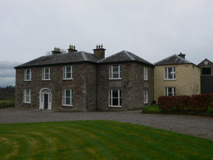 Carrigacunna CastleCountry house · 2.4 mi
Explorer Tom Carrigacunna Castle has been around since the fifteenth century and sits right on the edge of a cliff over the River Blackwater. It’s got medieval roots but has been updated with glazed link blocks recently, which is like wearing a suit to a beach party. The Vikings probably got lost looking for it because they didn't know about the upgrades.
Priest's WoodForest · 2.5 mi Ballyhooly CastleCastle · 3.3 mi
Explorer Tom Ballyhooly Castle in County Cork is an early sixteenth-century tower house. You can see part of the bawn wall on the right if you look closely. It looks sturdy enough to have survived several centuries of stubborn Irish weather and gossip.
 Children's playground3.6 miComputer-made picture
More mountains and hills in County Cork · All of County Cork

What do you know about this place?Tap to add a comment or ask a question