Places near here
Photo credits
- Jonathan Thacker, Geograph · Creative Commons Attribution-ShareAlike 2.0
- Colin Park, Geograph · CC BY-SA 2.0
- National Inventory of Architectural Heritage
- Alexander Redfern, Wikimedia Commons · CC BY-SA 4.0
- Miguel Angel Masegosa Martínez, Wikimedia Commons · CC BY 2.0
- Taken by Fanghong, Wikimedia Commons · CC BY-SA 3.0
Explorer Tom Enclosure in Broemountain sits on a slope and thinks Dublin tourists are all wind and no substance, frankly. It’s just a flattened bank with no clear entrance, which is perfect for confusing people who think they know what they’re doing. Ideal spot for making a dramatic phone call to your ex about nothing.
 Mount Melleray MonasteryChurch/chapel · 2.5 mi
Explorer Tom Mount Melleray Monastery has an ancillary church from 1850 that looks so serious it might frown if you hum a pop song. Rumor says a very famous rock star once hid here to escape paparazzi, though the monks just pretended he was a very noisy monk.
 KnockmealMountain / peak · 2.6 mi
Explorer Tom Knockmeal inspired a bad poem about its height that rhymed with 'cheese' and 'please'. The poet was drunk on the mountain air and his own mistakes. It's still trying to shake off that literary embarrassment today. Bring a coin for luck and keep it in your pocket.
 KnocknafalliaMountain / peak · 2.8 mi
Explorer Tom Knocknafallia is sick of being asked if it's haunted, because it just wants to nap in peace. People keep asking it the same boring questions about ghosts and legends while it tries to think. It would love to scream at them sometimes. Bring a flask of something warm and a story to swap.
Glenshelane Red WalkWalking route · 3.0 miExplorer Tom Glenshelane Red Walk would teach history if forced to, but its lectures are mostly about how great the view was in 1840 and why nobody remembers that. It’s got a bit of a temper, turning scarlet when you look at it wrong or step on a particularly prickly patch of bramble. Count the crows, then count again.
 Caherbrack HouseFarm house · 3.2 mi
Explorer Tom Caherbrack House is locked in a bitter feud with the next village over because they used the wrong colour paint on their fence in 1974, and nobody has spoken since then. It's still fuming about it.
Curraghcloney CastleCastle · 3.4 miExplorer Tom Curraghcloney Castle has a resident robin that refuses to leave, claiming ownership through sheer volume and aggressive chirping every morning at six. It’s basically the castle’s unpaid security guard with better instincts than the human staff. A good place to forget your phone for ten minutes.
WaterfallViewpoint · 3.4 miExplorer Tom This Waterfall is just water doing its thing, but with the confidence of a rock star who knows exactly where to stand. The bishop refused to visit because he said it was too wet for his shoes, which is classic, so find the wonkiest bit and send it to your group chat.
 Liam Lynch MonumentMonument · 4.0 mi
Explorer Tom The Liam Lynch Monument is still counting exactly how many cups of tea it took to build this thing in the first place. Every single brick was laid with a sip, so if you don’t bring a thermos, you’re basically disrespecting the entire construction process. Bring a flask and pretend you own the place.
Glenshelane Blue WalkWalking route · 4.0 miExplorer Tom Glenshelane Blue Walk has an imaginary fan club of sheep who follow it around thinking it’s a very long, blue ribbon leading to heaven. They baa approvingly at every turn, convinced they’re part of some divine plan involving wool and wet grass. Take the long way round, it deserves the effort.
 Sweet Chestnut4.5 mi
Explorer Tom Sweet Chestnut in County Waterford was planted by a man who had an elaborate escape plan involving a rope and a bucket, but he forgot the bucket. He left the tree behind as a souvenir of his failed genius. It’s a grand place for a sulk or a snog; your call which one you need today.
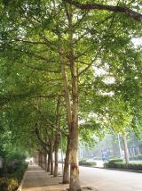 London Plane5.1 mi
Explorer Tom London Plane in County Waterford is claiming to be older than the hills, which is a bold move since it’s basically a street tree with delusions of grandeur. I bet it thinks it was planted by the Romans just to feel fancy. Stand exactly where the owner stood and practise your most smug, successful business owner face.
More mountains and hills in County Waterford · All of County Waterford

What do you know about this place?Tap to add a comment or ask a question