
What is recorded here
Knockloughra National School closed after a hundred years and became a place to stay. A bold choice for a bedroom: wake up late in a cold sweat about missing school, then discover you're already in it.
Detached seven-bay single-storey national school, dated 1884; extant 1897, on a U-shaped plan originally three-bay[?] single-storey on an L-shaped plan with single-bay single-storey gabled projecting lower end bays. Extended, 1958-9, producing present composition. Closed, 1984. Renovated to accommodate continued occasional residential use. Replacement pitched artificial slate roofs on a U-shaped plan including pitched (gabled) artificial slate roofs with clay ridge tiles terminating in repointed chimney stacks having concrete capping supporting terracotta pots, and cast-iron rainwater goods on timber eaves boards retaining cast-iron downpipes. Roughcast walls bellcast over rendered plinth. Square-headed central door opening below drag edged rusticated cut-limestone date stone ("1884") with concealed dressings framing replacement timber panelled door. Square-headed flanking window openings with concrete sills, and concealed dressings framing six-over-six timber sash windows. Set back from line of road in landscaped grounds.
A national school representing an integral component of the later nineteenth-century architectural heritage of County Mayo: meanwhile, aspects of the composition clearly illustrate the continued development or "improvement" of the national school in the twentieth century. Having been reasonably well maintained, the elementary form and massing survive intact together with quantities of the historic or original fabric, thus upholding the character or integrity of a national school making a pleasing visual statement in a rural street scene.
From the Buildings of Ireland (National Inventory of Architectural Heritage) record 31306706
This does not grant access. Most recorded buildings are privately owned; view them only from public ground unless the owner allows entry.
Places near here
Grave YardFairy fort / stone ringfort · 762 yd Killeen CemeteryVisitor information · 773 ydRockfleet LodgeHunting/fishing lodge · 1243 ydRaigh LodgeFarm house · 1366 ydBawn in RockfleetBawn · 1.0 miRockfleet Castle in RuinsCastle, tower house · 1.0 miRockfleet CastleCastle · 1.0 miBengormMountain / peak · 3.2 miInishnakillewIslet · 4.0 miCorranabinnia sw TopMountain / peak · 4.1 miGrave YardGraveyard · 5.0 miCollanmoreIsland · 5.0 mi
 Killeen CemeteryVisitor information · 773 yd
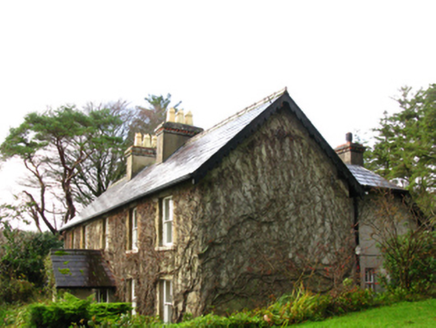 Rockfleet LodgeHunting/fishing lodge · 1243 yd
 Raigh LodgeFarm house · 1366 yd
 Bawn in RockfleetBawn · 1.0 mi
 Rockfleet Castle in RuinsCastle, tower house · 1.0 mi
 Rockfleet CastleCastle · 1.0 mi
 BengormMountain / peak · 3.2 mi
 InishnakillewIslet · 4.0 mi
 Corranabinnia sw TopMountain / peak · 4.1 mi
 Grave YardGraveyard · 5.0 mi
 CollanmoreIsland · 5.0 mi
Pictures: Robert Ashby, Geograph · CC BY-SA 2.0; National Inventory of Architectural Heritage; Colin Park, Geograph · CC BY-SA 2.0; N Chadwick, Geograph · CC BY-SA 2.0; Mikeoem, Wikimedia Commons · CC BY-SA 4.0; Kieran Campbell, Wikimedia Commons · CC BY-SA 2.0; Robert Ashby, Geograph · Creative Commons Attribution-ShareAlike 2.0; The original uploader was Cearbhalld at English Wikipedia ., Wikimedia Commons · Public domain
More historic places in County Mayo · All of County Mayo
What do you know about this place?