
What is recorded here
From OpenStreetMap (© OpenStreetMap contributors) n332372622
Places near here
Photo credits
- kevin higgins, Wikimedia Commons · CC BY-SA 2.0
- Colin Park, Geograph · CC BY-SA 2.0
- National Inventory of Architectural Heritage
- N Chadwick, Geograph · CC BY-SA 2.0
- Maker not stated on source page, www.pinterest.com
- Hywel Williams, Geograph · Creative Commons Attribution-ShareAlike 2.0
- Golfing in Ireland; photographer not stated, Source publisher
- Maker not stated on source page, www.flickr.com
 LyracappulMountain / peak · 1092 yd
Explorer Tom Lyracappul sits on the western Galtee ridge in County Limerick, a splendid name for a mountain that has no interest in…
 MonabrackMountain / peak · 1.0 mi
Explorer Tom Monabrack in County Limerick refuses to fall down because it thinks gravity is just a suggestion made by lazy clouds.…
 CarrignabinniaMountain / peak · 1.0 mi
Explorer Tom Carrignabinnia is the Galtees' trick question: after you have marched uphill expecting a triumphant point, its 822…
 SlievecushnabinniaMountain / peak · 1.4 mi
Explorer Tom Slievecushnabinnia sounds like Tom has sneezed halfway through ordering lunch, but this is a real summit on the…
 Assaroola BridgeBridge · 1.5 mi
Explorer Tom Assaroola Bridge is letting the local sheep have their say about its tiny arch. The animals think it’s too small for…
 Barrack BridgeBridge · 1.7 mi
Explorer Tom Barrack Bridge in Barna is locked in a drama with the nearest tree over who casts the better shadow. It crosses a…
 Paradise HillMountain / peak · 2.0 mi
Explorer Tom Paradise Hill in County Limerick is absolutely sick of people asking if it’s actually paradise, because let’s face it…
 Barna HouseHouse · 2.1 mi
Explorer Tom Barna House has a broad facade that map makers keep getting wrong because they think it’s two houses. The diminishing…
 Standing stone in Ballyarthur (condons and Clongibbon By., Marshalstown Par.)Standing stone · 4.5 mi
Explorer Tom Standing stone in Ballyarthur is a rectangular slab in rough grazing that has seen some wild things over the years. The…
 Ladys WellHoly well · 5.2 mi
Explorer Tom Ladys Well in Ballylanders in Limerick is in a churchyard with statues of Our Lady, looking very dignified. The builder…
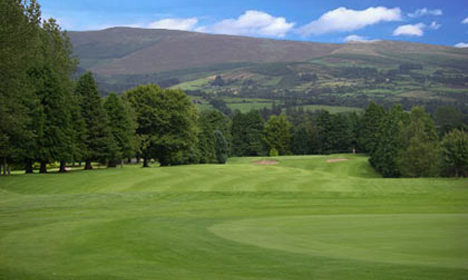 Mitchelstown Golf ClubGolf course · 5.3 mi
 Flat cemetery in DuntryleagueFlat cemetery · 6.2 mi
Explorer Tom Flat cemetery in Duntryleague has a curse that only affects people who don’t wave hello. Discovered in 1682, yet nobody…
More mountains and hills in County Limerick · All of County Limerick

What do you know about this place?Tap to add a comment or ask a question