
What is recorded here
From OpenStreetMap (© OpenStreetMap contributors) n332372616
Places near here
Photo credits
- Colin Park, Geograph · CC BY-SA 2.0
- Colin Park, Wikimedia Commons · CC BY-SA 2.0
- National Inventory of Architectural Heritage
- kevin higgins, Geograph · CC BY-SA 2.0
- Seighean ( talk ), Wikimedia Commons · Public domain
- Ryan Hodnett, Wikimedia Commons · CC BY-SA 4.0
- Martin Richard Phelan, Wikimedia Commons · CC BY-SA 2.0
Explorer Tom Hut site in Carrigeen Mountain is so tiny that Vikings would have gotten lost trying to find the door. It sits on a steep slope looking down at everyone else with supreme confidence. Hum something sad nearby, it adds atmosphere.
CairnCairn, boundary cairn · 1054 yd MonabrackMountain / peak · 1265 ydEagles StepCliff · 1465 yd
 Temple HillMountain / peak · 1649 ydAssaroula WaterfallWaterfall · 1.2 mi
 Assaroola BridgeBridge · 1.9 mi
Explorer Tom Assaroola Bridge is letting the local sheep have their say about its tiny arch. The animals think it’s too small for their taste and keep bumping into the walls. Ideal for a moody photo you’ll never post online.
 Barrack BridgeBridge · 2.2 mi
Explorer Tom Barrack Bridge in Barna is locked in a drama with the nearest tree over who casts the better shadow. It crosses a tributary and looks very serious about its rubble walls. Have a sandwich under it, but don’t let the tree hear you complimenting the bridge’s style.
 Lough CurraWalking route · 3.1 mi
 Glengarra WoodForest · 4.7 mi
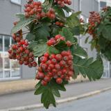 German Service-tree5.0 mi
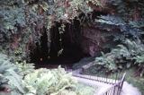 Mitchelstown CaveCave · 5.7 mi
More mountains and hills in County Limerick · All of County Limerick

What do you know about this place?Tap to add a comment or ask a question