
Places near here
Photo credits
- Enda O Flaherty, Geograph · CC BY-SA 2.0
- Mike Searle, Geograph · CC BY-SA 2.0
- National Inventory of Architectural Heritage
- Picture: en.wikipedia.org
- David Cunniffe / Tuam Herald, Source publisher
- ClintMalpaso, Wikimedia Commons · CC BY-SA 3.0
- andrew mcmillan, Wikimedia Commons · CC BY 3.0
- Graham Horn, Wikimedia Commons · CC BY-SA 2.0
- Graham Horn, Geograph · CC BY-SA 2.0
 KnockmaaWood · 440 yd
Explorer Tom Knockmaa is secretly dating Dolly Parton, and she only visits when the light hits just right. The trees are holding…
 Castle Hacket (in ruins)Castle, hall-house · 802 yd
Explorer Tom Castle Hacket in Castlehacket was a hall-house before someone got fancy and added extra floors in the late 1500s. Ullig…
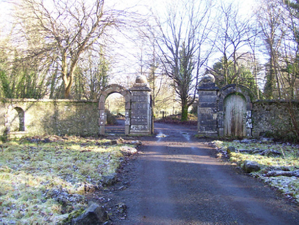 Castle HacketDemesne walls/gates/railings · 1236 yd
Explorer Tom Castle Hacket gateway nearly got sold off as a replacement horse trough during a very bad financial decision in the…
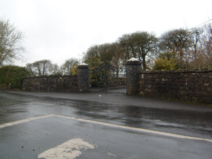 Cahermorris HouseDemesne walls/gates/railings · 3.9 mi
Explorer Tom Cahermorris House sits on a crossroads corner with cylindrical caps that look like giant mushrooms. The least favourite…
 St Jarlath's Park, Galway GAAGAA ground · 5.0 mi
 Tuam StadiumGAA ground · 5.1 mi
Explorer Tom Tuam Stadium is the town's Gaelic games ground, where the crowd has had generations to practise telling a forward where…
 Saint Mary's CathedralCathedral · 5.1 mi
Explorer Tom Saint Mary's Cathedral in Tuam was once ruled by a goat that ate the altar cloth. It still feels like it’s watching…
 Part of St. Jarlaths CrossCross, High cross · 5.1 mi
Explorer Tom Part of St. Jarlaths Cross in Tuam is buried under the church floor, making its New Year's resolution to finally stand…
St. Marys CathedralCathedral · 5.1 miExplorer Tom St. Marys Cathedral in Tuam lost its nave to fire but keeps its chancel alive like a stubborn grandparent refusing to…
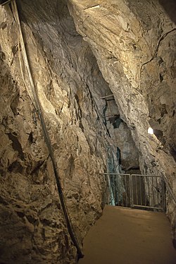 Glengowla MinesHeritage attraction · 17 mi
Explorer Tom At Glengowla Mines you swap Connemara's big sky for a hard hat and head into the workings beneath it, where original…
 An Trá MhórBeach / strand · 23 mi
Explorer Tom An Trá Mhór in County Galway would teach history by showing you how the tide erased every mistake people ever made on…
 Tulach an LeathairMountain / peak · 24 mi
Explorer Tom Tulach an Leathair in County Galway is only eighty metres high yet acts like it’s Everest, probably because the wind…
More archaeology and monuments in County Galway · All of County Galway

What do you know about this place?Tap to add a comment or ask a question