
What is recorded here
Freestanding lime kiln, arranged on circular plan, erected c. 1850, comprising of dry random rubble stone walls, rounded to parapet. Square-headed opening to north with flat stone lintel. Flue largely filled-in and partially overgrown. Located to side of road, south of Carrowmenagh. Site bounded by modern rubble wall and circular gate piers.
The production and use of lime was an essential part of land improvement and management, as well as building construction. As such this kiln is a reminder of a once important part of farming practice in Ireland. Although no longer in working condition, it retains its form relatively well and it is still possible to interpret its function. It is marked and described on the Ordnance Survey twenty-five inch map series (1888-1913). An interesting addition to the vernacular heritage of County Donegal.
From the Buildings of Ireland (National Inventory of Architectural Heritage) record 40901245
This does not grant access. Most recorded buildings are privately owned; view them only from public ground unless the owner allows entry.
Places near here
Photo credits
- National Inventory of Architectural Heritage
- James Emmans, Geograph · CC BY-SA 2.0
- Wanfried-Dublin, Wikimedia Commons · CC BY-SA 4.0
- Andreas F. Borchert, Wikimedia Commons · CC BY-SA 4.0
- Patrick Mackie, Geograph · CC BY-SA 2.0
- Kenneth Allen, Wikimedia Commons · CC BY-SA 2.0
- Corinna Schleiffer, Wikimedia Commons · CC BY-SA 2.0
- DAYVEHUSE, Wikimedia Commons · CC BY-SA 4.0
- Attila Terbócs, Wikimedia Commons · CC BY-SA 3.0
- Kenneth Allen, Geograph · CC BY-SA 2.0
 outbuilding211 yd
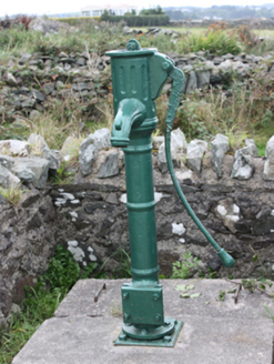 water pump329 yd
 Tremone BayBeach / strand · 1748 yd
.jpg/250px-Knockergrana_(5).jpg "Photo: Wanfried-Dublin, Wikimedia Commons · CC BY-SA 4.0") Former site of Knockergrana Court TombCourt tomb · 2.6 mi
Former site of Knockergrana Court TombCourt tomb · 2.6 mi Bocan Stone CircleStone circle · 3.2 mi
 CrockaulinMountain / peak · 3.2 mi
 CuldaffOfficial bathing water · 3.9 mi
 CrockavishaneMountain / peak · 4.2 mi
 CastleCastle, unclassified · 4.5 mi
 Cooly GraveyardGraveyard · 4.8 mi
 Cooley CrossMemorial · 4.8 mi
 Inishowen Maritime Museum and PlanetariumMuseum · 5.0 mi
More historic places in County Donegal · All of County Donegal
What do you know about this place?