
What is recorded here
From OpenStreetMap (© OpenStreetMap contributors) w1232470902
Places near here
Photo credits
- National Inventory of Architectural Heritage
- Maker not stated on source page, www.pinterest.com
- Malene Thyssen, Wikimedia Commons · CC BY-SA 3.0
- Stan Courtney, Geograph · CC BY-SA 2.0
- Kenneth Allen, Geograph · Creative Commons Attribution-ShareAlike 2.0
- Maker not stated on source page, www.flickr.com
- Maker not stated on source page, www.alamy.com
- Golfing in Ireland; photographer not stated, Source publisher
- Fintan McTiernan; published by Monaghan GAA, www.flickr.com
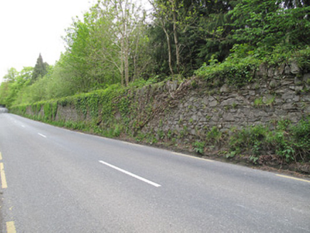 Hilton ParkDemesne walls/gates/railings · 698 yd
Explorer Tom Hilton Park walls are random rubble, which is basically fancy rocks stacked with attitude. They think tourists from…
 Scotshouse GraveyardGrave monument · 857 yd
Explorer Tom Scotshouse Graveyard monument would complain to the council about the weeds invading its family plot. It’s big and…
 Scotshouse CemeteryCemetery · 863 yd
Explorer Tom Scotshouse Cemetery in County Monaghan has had so many names it’s lost track, like a celebrity who keeps changing their…
 European Beech913 yd
Explorer Tom Another European Beech here remembers the day a goat tried to climb it and failed spectacularly. The whole valley saw…
 Carn WoodForest · 1011 yd
Explorer Tom Carn Wood in County Monaghan is throwing a massive history party that nobody invited you to, except Saint Patrick who…
 Catholic Church of the Immaculate ConceptionChurch/chapel · 1076 yd
Explorer Tom Catholic Church of the Immaculate Conception in Dunsrim would win the county fair for best dressed stone building. It’s…
 Standing stone in CarnroeStanding stone · 1106 yd
Explorer Tom Standing stone in Carnroe would be the guest at a wedding who stands by the door and judges everyone’s outfit choices…
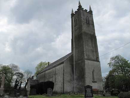 Saint Andrew's Church (Currin)Church/chapel · 1345 yd
Explorer Tom Saint Andrew's Church (Currin) was nearly sold for a horse, but the tower said no. It’s got stained glass that looks…
 Mapped graveyardGraveyard · 1354 yd
Explorer Tom this Mapped graveyard in County Monaghan is actually three hundred years older than it looks because time moves…
 Clones Golf ClubGolf course · 1536 yd
 Fairy fort / earthen ringfort in Gortnana (dartree By.)Fairy fort / earthen ringfort · 1555 yd
Explorer Tom Fairy fort / earthen ringfort in Gortnana is at the end of a ridge with a bank that’s reduced to a scarp on one side. I…
 Páirc Churraichín, Currin Sons of St PatrickGAA ground · 1629 yd
More archaeology and monuments in County Monaghan · All of County Monaghan

What do you know about this place?Tap to add a comment or ask a question