What is recorded here
According to Bradley et al. (1986 vol. 3, 292-303), Kill (KD019-008001-) formed part of 'the cantred of Offelan nearest to Dublin' which was granted by Strongbow to Adam de Hereford in the sub-infeudation of Leinster in the early 13th century, around which time, or possibly slightly earlier, the motte was erected,…
Read the whole record
From the National Monuments Service (Archaeological Survey of Ireland) record KD019-008004
Places near here
Picture notes
- Computer-made picture. It does not show this monument.
- Darrin Antrobus, Wikimedia Commons · CC BY-SA 2.0
- National Inventory of Architectural Heritage
- Computer-made picture. It does not show this mountain top.
- Alvesgaspar, Wikimedia Commons · CC BY-SA 3.0
- Sitomon, Wikimedia Commons · CC BY-SA 2.0
- Computer-made picture. It does not show this playground.
- Computer-made picture. It does not show this garden.
- Mike Searle, Geograph · CC BY-SA 2.0
 Fulacht fia in KillhillFulacht fia · 134 ydComputer-made picture
Explorer Tom Fulacht fia in Killhill has caught my eye in Killhill, County Kildare. I bet a fulacht fia with a name like that could keep me talking all afternoon; I'm already inventing a daft little scene for it, and I'll stop before it turns into history.
 Settlement desertedSettlement deserted, medieval · 335 ydComputer-made picture
Explorer Tom Settlement deserted has caught my eye in Kill East (kill Ed), Kill West, Killhill, County Kildare. I bet a settlement deserted, medieval with a name like that could keep me talking all afternoon; I'm already inventing a daft little scene for it, and I'll stop before it turns into history.
 Headstone in Kill WestHeadstone · 389 ydComputer-made picture
Explorer Tom Headstone in Kill West has caught my eye in Kill West, County Kildare. I bet a headstone with a name like that could keep me talking all afternoon; I'm already inventing a daft little scene for it, and I'll stop before it turns into history.
 Saint John's Church (Kill)Church/chapel · 408 yd
Explorer Tom Saint John's Church (Kill) has caught my eye in Kill West, County Kildare. I bet a church/chapel with a name like that could keep me talking all afternoon; I'm already inventing a daft little scene for it, and I'll stop before it turns into history.
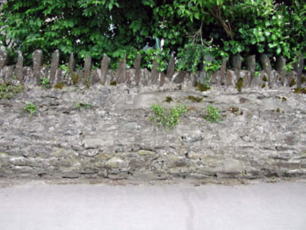 gates/railings/walls408 yd
Explorer Tom Gates in Killhill has caught my eye in Killhill, County Kildare. I bet a gates/railings/walls with a name like that could keep me talking all afternoon; I'm already inventing a daft little scene for it, and I'll stop before it turns into history.
 Kill HillMountain / peak · 728 ydComputer-made picture
Explorer Tom Kill Hill has caught my eye in County Kildare. I bet a mountain / peak with a name like that could keep me talking all afternoon; I'm already inventing a daft little scene for it, and I'll stop before it turns into history.
 Black HillMountain / peak · 1.2 miComputer-made picture
Explorer Tom Black Hill has caught my eye in County Kildare. I bet a mountain / peak with a name like that could keep me talking all afternoon; I'm already inventing a daft little scene for it, and I'll stop before it turns into history.
 Common Lime1.4 mi
Explorer Tom Common Lime has caught my eye in County Kildare. I bet a common lime with a name like that could keep me talking all afternoon; I'm already inventing a daft little scene for it, and I'll stop before it turns into history.
 European Yew1.7 mi
Explorer Tom European Yew has caught my eye in County Kildare. I bet a european yew with a name like that could keep me talking all afternoon; I'm already inventing a daft little scene for it, and I'll stop before it turns into history.
 Children's playground1.9 miComputer-made picture
Explorer Tom Children's playground has caught my eye in County Kildare. I bet a children's playground with a name like that could keep me talking all afternoon; I'm already inventing a daft little scene for it, and I'll stop before it turns into history.
 Hunting BrookGarden · 4.5 miComputer-made picture
Explorer Tom Hunting Brook has caught my eye in County Wicklow. I bet a garden with a name like that could keep me talking all afternoon; I'm already inventing a daft little scene for it, and I'll stop before it turns into history.
 CastleCastle, tower house · 4.8 mi
Explorer Tom Castle in Newcastle North is a flat-topped mound that looks like a giant’s pillow left out in the rain. It’s been sitting there since 1200, judging the church next door without saying a word. Snap one photo, then put the phone away and actually look.
More castles and forts in County Kildare · All of County Kildare

What do you know about this place?Tap to add a comment or ask a question