What is recorded here
Marked 'Kill Burial Gd. for Children' on OS 6-inch map (1842). On W-facing slope overlooking Traguman Bay. Rectangular area (c. 16m NW-SE; c. 6m NE-SW) inaccessible due to heavy overgrowth. According to local information, gravemarkers within and field known as "Kill field".
From the National Monuments Service (Archaeological Survey of Ireland) record CO150-031
The monument record does not grant public access. Check the route and ask the landowner before entering private land.
- What survives
- Recorded monument
Places near here
Photo credits
- Mac McCarron, Geograph · CC BY-SA 2.0
- Martin Southwood, Geograph · CC BY-SA 2.0
- National Inventory of Architectural Heritage
- Mac McCarron, Geograph · Creative Commons Attribution-ShareAlike 2.0
Cuas na mBarcBeach / strand · 671 yd Drishane IslandIslet · 837 ydStony BeachBeach / strand · 861 ydMan-made underground passage in Bawnlahan (carbery West (e.d.) By., Castlehaven Par.)Man-made underground passage · 1022 ydWild Atlantic Way:Toe HeadVisitor information · 1300 ydWild Atlantic Way:Toe Head BayVisitor information · 1718 ydAn GoibínHeadland · 1.1 miBullock IslandIslet · 1.1 miFaill ChúCliff · 1.2 miLough Ine HouseHunting/fishing lodge · 1.7 miquay/wharf1.9 miShour WellHoly well · 2.2 mi
 Drishane IslandIslet · 837 ydStony BeachBeach / strand · 861 ydMan-made underground passage in Bawnlahan (carbery West (e.d.) By., Castlehaven Par.)Man-made underground passage · 1022 ydWild Atlantic Way:Toe HeadVisitor information · 1300 ydWild Atlantic Way:Toe Head BayVisitor information · 1718 ydAn GoibínHeadland · 1.1 mi
 Bullock IslandIslet · 1.1 miFaill ChúCliff · 1.2 mi
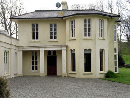 Lough Ine HouseHunting/fishing lodge · 1.7 mi
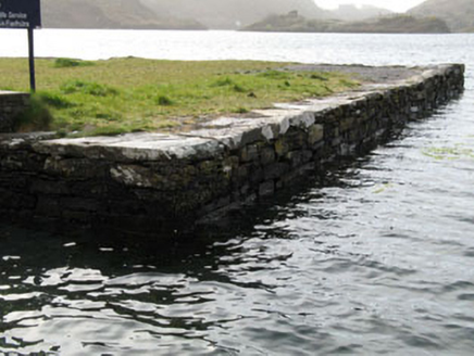 quay/wharf1.9 mi
 Shour WellHoly well · 2.2 mi
More archaeology and monuments in County Cork · All of County Cork
What do you know about this place?