
More pictures of this place


What is recorded here
The walls are only the start of this story. The bridge was commissioned by John Anderson, founder of Fermoy, and was executed by Joshua Hargrave to a design by A.
Seven-arch limestone road bridge over River Blackwater, dated 1864 and 1865, and built at site of seventeenth-century bridges and of medieval ferry. Coursed rock-faced ashlar piers and spandrels, snecked to parapets having cut-stone copings, chanelled ashlar voussoirs to segmental arches, with cut limestone string course between arches and parapets. Parapets to road having dressed snecked facing. U-cutwaters to piers, with carved limestone caps and imposts, latter continuing as course to underside of arches and to landward abutments, and rock-faced ashlar below. Carved limestone plaque to west parapet wall. Southern three arches accommodate mill race, bounded to north by weir. Rubble limestone approach wall to north side of east parapet marking line of approach to earlier bridge. Wall contains inserted keystone with date 1718, and sandstone overflow arch.
The bridge was commissioned by John Anderson, founder of Fermoy, and was executed by Joshua Hargrave to a design by A.
This substantial road bridge is the latest structure at this site, the earliest having been erected in the late sixteenth century. The bridge was commissioned by John Anderson, founder of Fermoy, and was executed by Joshua Hargrave to a design by A. Oliver Lyons. It carries the main Dublin to Cork road and in the past, Fermoy was also on one of the main mail coach routes. Its structure of large blocks in rock-faced limestone gives it an imposing and solid appearance. Evidence of fine stone crafting can be seen in these blocks and in the dressed coping and cutwaters.
The story behind this place
The bridge was commissioned by John Anderson, founder of Fermoy, and was executed by Joshua Hargrave to a design by A.
This does not grant access. Most recorded buildings are privately owned; view them only from public ground unless the owner allows entry.
Places near here
 Fermoy BrBridge · 5 yd
 Kent BridgeMemorial · 60 yd
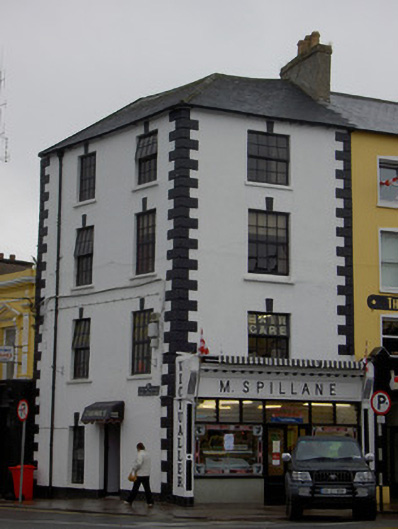 M. Spillanehouse · 89 yd
 Tourist InformationVisitor information · 101 yd
 Graveyard in FermoyGraveyard · 216 yd
 St Bernards WellHoly well · 624 yd
 Burial GroundGraveyard · 814 yd
 Old Railway ViaductViewpoint · 1579 yd
 Carrigabrick Castle (in Ruins)Castle, tower house · 1633 yd
 Ballybrack WoodForest · 1.2 mi
 Licklash Castle (in Ruins)Castle, hall-house · 1.3 mi
 Strawhall WoodForest · 1.5 mi
Other information
Photo: Andreas F. Borchert · CC BY-SA 4.0