What is recorded here
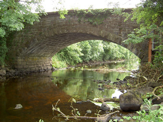
Johnston's Bridge in Cloonageeher has three old arches standing over dry ground while the newer arch handles the river. Three supervisors and one lad doing the work, and we thought that was a recent invention.
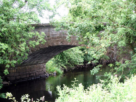
Single-arched humpback road bridge over Rinn River, built c. 1860, incorporating three arches of earlier bridge, dated 1809 (date plaque) to the west side (in County Leitrim). Possibly containing earlier fabric (to the west). Segmental-headed arch with rock-faced voussoirs and squared dressed limestone barrel. Round-headed arches to earlier bridge structure having dressed limestone voussoirs. Roughly dressed squared and snecked limestone spandrel walls, squared limestone abutments. Squared limestone rubble parapet walls having dressed limestone coping over (with bevelled edge to outer faces). Rubble stone wing walls to both ends (east and west). Three redundant arches of former bridge to the west with oval plaque dated ‘1809’. Name ‘Johnson‘s Bridge’ now erased. Located to the extreme north end of County Longford, on border with County Leitrim.
This interesting bridge contains fabric from two distinct phases of construction. A number of arches from an earlier bridge, dated 1809, survive to the west side of the bridge, while the wide segmental arch over the river dates to the mid-nineteenth century. The form of the wide arch (with the rock-faced voussoirs to the arch) suggests that this bridge was remodelled by the Board of Works c. 1860, possibly as part of a drainage programme as the river was dredged at this time (arches of earlier bridge to the west now dry). Although simple in design, this bridge is a good example of nineteenth century engineering with good-quality stonemasonry in evidence throughout. The combination of squared rubble, rock-faced and dressed limestone used in its construction adds textural variation to the bridge’s appearance. The bridge marks an important geographical boundary between counties Longford and Leitrim, and is an integral element of the architectural heritage of the area. This bridge is depicted as a multiple-arch bridge with cutwaters on the Ordnance Survey first edition six-inch map of the area (1838), suggesting that the present bridge may contain earlier fabric (pre-1750) and is a long-established crossing point of the Rinn River. This relatively small span of the arches to the earlier bridge (and the wide piers between the arches) would also suggest that this part of the bridge is of considerable antiquity.
From the Buildings of Ireland (National Inventory of Architectural Heritage) record 13400401
This does not grant access. Most recorded buildings are privately owned; view them only from public ground unless the owner allows entry.
Places near here
 Johnston's BridgeBridge · 1 yd
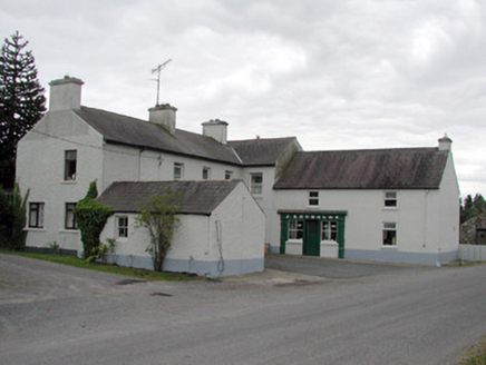 J. ReynoldsHouse · 136 yd
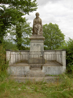 monument531 yd
 Grave YardGraveyard · 1545 yd
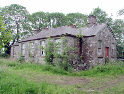 Clooneagh National SchoolSchool · 1.5 mi
 Cavan & Leitrim RailwayMuseum · 3.1 mi
 Lebanon Cedar3.9 mi
.jpg/250px-Castle_Forbes,_Longford,_Co._Longford_(21680992271).jpg "Photo: Robert French, Wikimedia Commons · No restrictions") CastleforbesCastle · 3.9 miLebanon Cedar4.0 mi
CastleforbesCastle · 3.9 miLebanon Cedar4.0 mi Lough Rynn HouseCastle · 4.6 mi
 Saint Mel's CathedralCathedral · 7.4 mi
 First World War MemorialMemorial · 7.5 mi
Pictures: National Inventory of Architectural Heritage; Davidcorry200, Wikimedia Commons · CC BY-SA 4.0; Reading Tom, Wikimedia Commons · CC BY 2.0; Olivier BEZES, Wikimedia Commons · CC BY 2.5; Robert French, Wikimedia Commons · No restrictions; SE Keenan, Wikimedia Commons · CC BY-SA 4.0; 瑞丽江的河水, Wikimedia Commons · CC BY-SA 4.0
More historic places in County Longford · All of County Longford
What do you know about this place?