DDiscover AloneMapAbout

Jerpoint Abbey

Religious house, Cistercian monks
Jerpoint Abbey
Representative picture, exact place not confirmed
Photo: Maker not stated on source page, www.pinterest.com · Report the wrong picture

The monument record does not grant public access. Check the route and ask the landowner before entering private land.

What do you know about this place?Tap to add a comment or ask a question

What you write will be public.

What is recorded here

On the E bank of the Little Arrigle River, which flows c. 400m to the N into the River Nore. The road from Thomastown to Ballyhale runs past the W side of the abbey. It is likely that the abbey was founded by Donal Mac Gillapatrick, King of Ossory, in 1158 for the Benedictines (Gwynn and Hadcock 1988, 136; Stalley…

Read the whole record
On the E bank of the Little Arrigle River, which flows c. 400m to the N into the River Nore. The road from Thomastown to Ballyhale runs past the W side of the abbey. It is likely that the abbey was founded by Donal Mac Gillapatrick, King of Ossory, in 1158 for the Benedictines (Gwynn and Hadcock 1988, 136; Stalley 1987, 261-2). In 1180 it became a daughter house of the Cistercians of Baltinglass Abbey (WI027-024001-). Jerpoint, in its turn, became the mother house for the abbeys of Kilcooly, Co. Tipperary (KK043-034001-) and Killenny, Co. Kilkenny in 1184, the latter being suppressed in 1227 having incurred massive debts and was amalgamated with Graiguenamanagh Abbey, Co. Kilkenny (Gwynn and Hadcock 1988, 136, 138). In 1227 Jerpoint became affiliated to Fountains Abbey in Yorkshire (Harbison 1992, 198). In 1442, ‘an indulgence was granted for the repair of the cloister, dormitory, bell-tower, other offices and the chapel of St Moling’ (Gwynn and Hadcock 1988, 137). Following the dissolution of the monastery in 1540 the jurors, listing the property of the abbey, found that, ‘the roof of the chancel had been thrown down before the dissolution, the nave had been the parish church from time immemorial, the cloister, dormitory and adjoining buildings could be thrown down, but all other buildings were necessary for the farmer’ (ibid.). The property was granted to Thomas Butler, Earl of Ormond, in 1558 (ibid.). The abbey plan conforms to that of a typical Cistercian monastery, with a church standing on the N side of a quadrangle, on the other three sides of which lay the cloister and the conventual buildings including the sacristy, chapter house, refectory, dormitory and kitchen. Of these the E range including the vaulted sacristy, chapter house, parlour and some of the dormitory windows survive, while the S and W ranges are more fragmentary (Stalley 1987, 247). The church has a square chancel, with two chapels in each transept and a nave with side aisles. The E end of the church may date to as early as 1160, though the original E window was replaced by the present window in the 14th century (Harbison 1992, 199). Stalley (1987, 247) attributes the capitals at the E end to the work of the ‘Baltinglass Master’. The rest of the church was built c. 1180, and although the aisles have bluntly pointed Gothic arches, the capitals are still Romanesque in character, as are the round-headed windows in the W wall (Harbison 1992, 198-9). A low wall was built up between the pillars of the aisle, and against it were placed the wooden choir-stalls (ibid. 199). A cross-wall separated the monks in the eastern part of the church from the lay-brothers (ibid.). The six-bay nave has piers of alternating square and circular form (except the final two bays) and masonry screen walls divide the nave from the aisles (Stalley 1987, 247). In the 15th century, considerable reconstruction took place, the N wall of the nave was rebuilt, the large square tower was placed above the crossing and the S aisle was extended outwards (ibid.). The nave preserves some rare medieval heraldic frescoes. The cloister arcade, dated by Stalley (ibid.) to c. 1390-1400, was reinstated in 1953 and displays a variety of figure sculpture of saints, knights etc. There are also some very fine sculpture tombs, including an effigy of Felix O Dulany, Bishop of Ossory (1178-1202) (Hunt 1974, vol. 1, 173, vol. 2, plate 61) and a late 13th-century incised effigy of two knights (ibid. vol. 1, 173-4, vol. 2, plate 5). (National Monument no. 80) Compiled by: Jean Farrelly Date of upload: 1 May 2020

From the National Monuments Service (Archaeological Survey of Ireland) record KK028-062005

Places near here

Photo credits
  • Maker not stated on source page, commons.wikimedia.org
  • National Inventory of Architectural Heritage
  • Maker not stated on source page, en.wikipedia.org
  • A.-K. D., Wikimedia Commons · CC BY-SA 4.0
  • Maker not stated on source page, kilkennycoco.ie
  • Maker not stated on source page, www.flickr.com
Ogham stone (present location) in JerpointabbeyOgham stone (present location) · 19 yd

Explorer Tom Ogham stone in Jerpointabbey is having a serious falling out with the tree right next to it. They used to be best…

Abbey HouseMill (water) · 147 yd

Explorer Tom Abbey House in Jerpointabbey is a ruined mill that used to grind grain but now grinds your patience with its broken…

Earthwork in JerpointchurchEarthwork · 370 yd

Explorer Tom Earthwork in Jerpointchurch is playing hard to get, hiding from the Vikings who got hopelessly lost looking for it back…

Church in JerpointchurchChurch · 496 yd

Explorer Tom Church in Jerpointchurch was built on a bargain where the stonemason got paid in bread and the priest got paid in…

St. Nicholas's GraveyardGraveyard · 500 yd

Explorer Tom St. Nicholas's Graveyard has hidden messages in its stones, but they’re mostly just complaints about the weather from…

Graveyard in JerpointchurchGraveyard · 510 yd

Explorer Tom Graveyard in Jerpointchurch hears everything through the old walls, including your mumbling from yesterday. It’s been…

St. Nicholas TombTomb, unclassified · 530 yd

Explorer Tom St. Nicholas Tomb in Jerpointchurch is not a shortcut. People try to use it as a path, but it’s really a tomb. St.…

Holy WellSpring · 543 yd

Explorer Tom Holy Well got its location wrong on the map because the surveyor was three pints deep and thought the hill looked like…
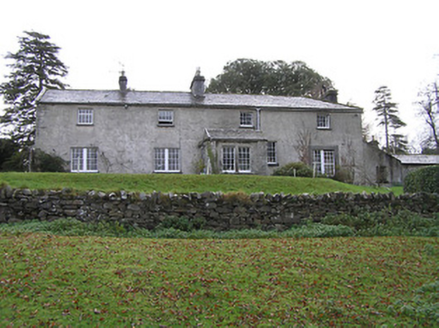
BelmoreHouse · 677 yd

Explorer Tom Belmore in Jerpointchurch bragged about surviving a storm that turned its hunting lodge plans upside down completely.…

Goat's BridgeBridge · 709 yd

Explorer Tom Goat's Bridge got its name because the map makers were drunk, or maybe just very hungry for goat meat. It’s a low-slung…
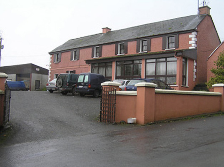
miller's house750 yd

Explorer Tom The Miller’s house is haunted by a bishop who refused to visit because he was too busy eating pie. He still lingers…

viaduct949 yd

Explorer Tom Viaduct in Jerpoint West is showing off to the river, claiming it’s still the longest single span in the British Isles.…

More historic places in County Kilkenny · All of County Kilkenny

Add to this placeAdd a picture Add a detailed tip Add a story

Explore the map1,095,414 places to discover

Next place · or swipeOgham stone (present location) in Jerpointabbey