What is recorded here
Places near here
Photo credits
- Andreas F. Borchert, Wikimedia Commons · CC BY-SA 4.0
- National Inventory of Architectural Heritage
- Kenneth Allen, Geograph · CC BY-SA 2.0
- Rossographer, Geograph · CC BY-SA 2.0
- John M, Geograph · CC BY-SA 2.0
- Patrice78500, Wikimedia Commons · CC BY-SA 3.0
- Anne Burgess, Wikimedia Commons · CC BY-SA 2.0
- Kieran Evans, Wikimedia Commons · CC BY-SA 4.0
 Mevagh High CrossCross, High cross · 1.1 mi
Explorer Tom Mevagh High Cross is a stark, undecorated slab standing in the graveyard of a ruined medieval church. It’s simple and unadorned, which makes it feel like a quiet guardian overlooking the steep drop to Mulroy Bay. No fancy patterns here, just raw stone and history.
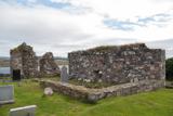 Mevagh Old ChurchChurch · 1.1 mi
Explorer Tom Mevagh Old Church was called an ancient ruined parish church in a 1622 record. The later survey describes parts of its east and west gables and south wall; near one corner lay a separate stone with twenty-three cup marks. I followed the church outline in the record and found another question beside it.
 John MorrowHouse · 1.1 mi
Explorer Tom John Morrow in Leat Beg has a shop sign that spells his name with two r’s! Built around 1930, I bet the sign painter just ran out of patience. It feels like a very confident typo on the corner.
 Carrigart HotelHotel · 1.3 mi
Explorer Tom Carrigart Hotel on Main Street is where ghosts go to relax after haunting castles all day long. Ask for room four; if it’s cold, just say you prefer the arctic breeze there. Best visited with a curious kid and no timetable.
 Caife Na SraideCafé · 1.3 mi
Explorer Tom Caife Na Sraide in County Donegal is on the street, so expect to share your pastry with pigeons. It's charming, it's chaotic, and the coffee is probably strong enough to wake the dead. Make a wish, it's had centuries of practice at this game.
 DowningsOfficial bathing water · 1.8 mi
Explorer Tom Downings gets to sit snug in Sheephaven Bay while Rosguill takes the Atlantic full in the face. I can almost hear the peninsula boasting about the arrangement. Donegal tourism lists windsurfing here, though the wind gets the final say on any plans for the water.
 Rosses StrandBeach / strand · 2.3 mi
Explorer Tom Rosses Strand is keeping it low-key with waves under a foot high, which is basically a nap for the sea. It’s resting its head on my shoulder right about now. Look up, the best bit is always higher than you think.
 Cnoc na SleáMountain / peak · 2.5 mi
Explorer Tom Cnoc na Sleá means 'hill of the spear', though I would leave any spear firmly in the name. The guide also calls this small Donegal hill Crocknasleigh and points out its older Irish spelling. One hill, two ways to say it, and a very pointed name.
 Cliffs at Lamb's IslandPublicly named cliff or headland · 2.7 mi
Explorer Tom Cliffs at Lamb's Island are exactly what they say: rocky drops near an island that might not even have any sheep on it. The birds probably rule the roost there. Keep your footing secure and try not to scare the gulls off their lunch spots.
 Cliffs north of DowniesPublicly named cliff or headland · 2.7 mi
Explorer Tom Cliffs north of Downies are just cliffs, but they look like they’ve seen some things. The name 'Downies' makes me think of sheep, so I’m expecting them any minute now. Ten minutes here and you'll have a yarn for the pub.
 The Murder HoleCave · 2.9 mi
Explorer Tom The Murder Hole in County Donegal is a cave with a bit of a dramatic reputation. It’s probably just a damp tunnel, but the name really sells the mystery. I’m sure there’s no actual murder, just vibes and bad lighting.
 Moross CastleCastle, tower house · 3.2 mi
Explorer Tom Moross Castle was built in 1532 and sits on a tiny rocky island connected by a causeway. By 1622, someone had slapped a thatched roof on the ruins while it lay waste, which is peak medieval DIY. Only the southwest corner survives now, but that narrow causeway makes it feel like you’re walking onto a very defensive boat.
More islands in County Donegal · All of County Donegal

What do you know about this place?Tap to add a comment or ask a question