What is recorded here
From the National Monuments Service (Archaeological Survey of Ireland) record DU025-017002
Places near here
Photo credits
- National Inventory of Architectural Heritage
- Maker not stated on source page, commons.wikimedia.org
- Maker not stated on source page, ru.pinterest.com
- D18Steve, Wikimedia Commons · CC BY-SA 4.0
- Maker not stated on source page, uk.pinterest.com
- Maker not stated on source page, www.flickr.com
- Discover Ireland; photographer not stated, Discover Ireland
- JP, Geograph · CC BY-SA 2.0
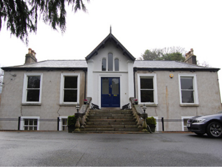 Kilgobbin CastleHouse · 83 yd
Explorer Tom Kilgobbin Castle thinks the local sheep have a better sense of style than it does, which is rude but probably true.…
 Linear earthwork in KilgobbinLinear earthwork · 112 yd
Explorer Tom Linear earthwork in Kilgobbin is a lane that used to be a bank, which then became a ditch, now it’s just a path. It’s…
 Holy well in KilgobbinHoly well · 331 yd
Explorer Tom Holy well in Kilgobbin was the 'Eye Well' near the old church, but a drain sunk nearby removed its spring entirely. Its…
 CrossCross, High cross · 408 yd
Explorer Tom Cross in Kilgobbin has an unlikely celebrity friend: a broken head from the same era, probably just chilling nearby.…
 Bullaun stone in KilgobbinBullaun stone · 410 yd
Explorer Tom Bullaun stone in Kilgobbin is actually the base of a 12th-century high cross. It's got a shallow basin cut into its…
 mausoleum414 yd
Explorer Tom Mausoleum in Kilgobbin is a granite vault from 1909 on a hillside. It’s got an embossed iron panel and lichen…
 Mapped graveyardGraveyard · 419 yd
Explorer Tom Mapped graveyard in County Dublin has had so many name changes it’s got more aliases than a spy in a bad thriller. I…
 Church (in Ruins)Church · 425 yd
Explorer Tom Church in Kilgobbin has strict visitor rules: no loud noises, no dogs, and absolutely no one wearing neon yellow…
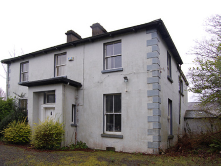 Clay FarmFarm house · 516 yd
Explorer Tom Clay Farm in Kilgobbin is a farmhouse from 1869 on a cruciform plan. It might have an older core from the thirties…
 Graveyard in KilgobbinGraveyard · 1222 yd
Explorer Tom Graveyard in Kilgobbin has been heavily landscaped for a golf course, which is a bold move. It's just a levelled area…
 Explorium: National Sport and Science CentreMuseum · 1.2 mi
Explorer Tom Explorium on Blackglen Road in Sandyford has a splendid answer to anyone who says science should be studied quietly…
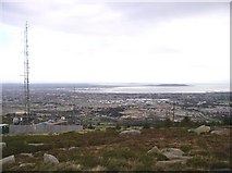 Three Rock MountainMountain / peak · 1.2 mi
Explorer Tom Three Rock Mountain is where Saint Patrick probably went to hide when he realised he’d run out of snakes and had no…
More historic places in County Dublin · All of County Dublin

What do you know about this place?Tap to add a comment or ask a question