
What is recorded here
From the Irish Caves Database, University of Bristol Spelæological Society record 1603
Places near here
Photo credits
- Maker not stated on source page, www.dreamstime.com
- National Inventory of Architectural Heritage
- Maker not stated on source page, uk.pinterest.com
- Nigel Thompson, Geograph · Creative Commons Attribution-ShareAlike 2.0
- Maker not stated on source page, irisharchaeology.org
- Maker not stated on source page, storage.googleapis.com
- Kmcnamee, Wikimedia Commons · CC BY-SA 4.0
- The Clare Echo; photographer not named in the article, www.clareecho.ie
- Paul Woods, Wikimedia Commons · CC BY 2.0
- The Banner, Wikimedia Commons · CC BY-SA 3.0
 Teampall na Deirce GraveyardGraveyard · 1122 yd
Explorer Tom Teampall na Deirce Graveyard in County Clare witnessed a guy drop his sandwich in 1998, which was arguably the most…
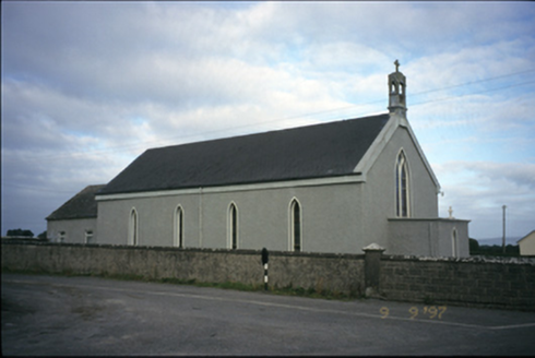 Saint Michael's Catholic ChurchChurch/chapel · 1.3 mi
Explorer Tom Saint Michael's Catholic Church in Creggaunycahill is an 1850 church with a carved limestone bellcote that looks like…
 Moyree Castle (in Ruins)Castle, tower house · 1.4 mi
Explorer Tom Moyree Castle is a tower house where the seagulls have formed a union and demand tribute for every view they block.…
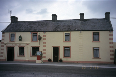 M. O'GradyHouse · 1.7 mi
Explorer Tom M. O'Grady in Carrowcraheen is a house that used to be a post office, which means it knows where all your letters went.…
 Tubber Railway StationRailway station · 2.0 mi
Explorer Tom Tubber Railway Station in Rathwilladoon is proud of its timber sign even though no trains have come for ages. It’s been…
 bridge2.0 mi
Explorer Tom Bridge in Rathwilladoon has changed its name so many times it's given up and just goes by Bridge for now. It sits next…
 Megalithic tomb in Knockmael EastMegalithic tomb · 2.1 mi
Explorer Tom Megalithic tomb in Knockmael East is playing hide-and-seek with me. A tale from 1846 says an earl built it, but there…
 Fairy fort / stone ringfort in BallinlisheenFairy fort / stone ringfort · 2.2 mi
Explorer Tom Fairy fort / stone ringfort in Ballinlisheen thinks the road leading to it is a bit too pretentious and tries to hide…
 Crusheen GAA pitchGAA ground · 2.4 mi
 Tubber GAA pitchGAA ground · 3.1 mi
 Mullagh MoreMountain / peak · 5.0 mi
Explorer Tom Mullaghmore looks as if the Burren folded a stone tablecloth and forgot to flatten it. The limestone hill rises only…
 Burren National ParkNature reserve · 5.9 mi
Explorer Tom The Burren National Park is Ireland's smallest national park, and it still gives you 1,500 hectares in which to lose an…
More caves in County Clare · All of County Clare

What do you know about this place?Tap to add a comment or ask a question