What is recorded here
On a height overlooking the River Nore which flows roughly N-S c. 280m to the W. An enclosure (KK028-001----) lies c. 100m to the WNW and another (KK028-003----) lies c. 200m to the SE. Indicated on the 1st (1839) ed. OS 6-inch map as a sub-rectangular enclosure (overall dims. c. 55m NE-SW; c. 38m NW-SE) with a field boundary running WNW-ESE through the northern sector and another running from this field boundary SSE through the centre of the monument. On satellite imagery (Digitalglobe 2011-2013) the enclosure is visible defined by a low bank.
From the National Monuments Service (Archaeological Survey of Ireland) record KK028-002
Places near here
Photo credits
- National Inventory of Architectural Heritage
- Humphrey Bolton, Geograph · CC BY-SA 2.0
- A.-K. D., Wikimedia Commons · CC BY-SA 4.0
- R. A. Nonenmacher, Wikimedia Commons · CC BY-SA 4.0
- Paddy O'Shea, Wikimedia Commons · Public domain
- Dave Henderson, Wikimedia Commons · CC BY-SA 2.0
- Eirian Evans, Geograph · CC BY-SA 2.0
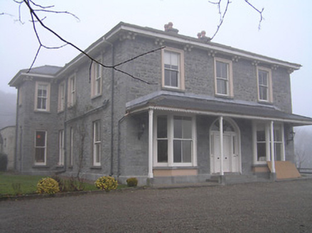 Crohana HouseCountry house · 775 yd
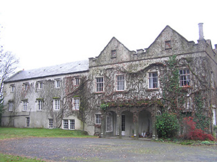 Annamult HouseCountry house · 1226 yd
 Annamult Castle (in ruins)Castle, tower house · 1.0 mi
 Grave YardGraveyard · 1.7 mi
 Black Walnut1.9 mi
 Kilbline CastleCastle, tower house · 1.9 mi
 TobermogueHoly well · 2.0 mi
 John Patrick KennedyMemorial · 2.7 mi
 Tullaherin Church and Round TowerVisitor information · 2.8 mi
 Kells Augustinian PrioryArchaeological place · 3.7 mi
 Kells Loop WalkWalking route · 3.7 mi
 Kells Priory Mill MuseumMuseum · 3.7 mi
More archaeology and monuments in County Kilkenny · All of County Kilkenny

What do you know about this place?Tap to add a comment or ask a question