Places near here
Photo credits
- National Inventory of Architectural Heritage
- Brian Shaw, Geograph · CC BY-SA 2.0
- Ellie Berry / Tough Soles, Tough Soles
- St Michael’s GAA Club blog; photographer not named, stmichaelsgaa.blogspot.com
- Kmcnamee, Wikimedia Commons · CC BY-SA 4.0
- Oliver Dixon, Geograph · CC BY-SA 2.0
- Kieran Campbell, Wikimedia Commons · CC BY-SA 2.0
- Sawyer777, Wikimedia Commons · CC BY-SA 4.0
- Gillaween, Wikimedia Commons · CC BY-SA 4.0
- Bob Embleton, Wikimedia Commons · CC BY-SA 2.0
- Djm-leighpark, Wikimedia Commons · CC BY-SA 4.0
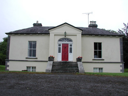 Riversdale HouseCountry house · 1.5 mi
Explorer Tom Riversdale House in Kilteasheen is hiding its true size behind a facade of classical proportions, like it’s trying to…
 Knockvicar BridgeOfficially recorded historic building · 1.8 mi
Explorer Tom Knockvicar Bridge in Kilteasheen has been smuggling contraband whiskey for centuries, or so the legend goes, right…
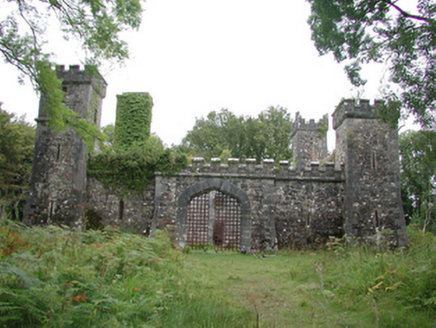 Cloontykilla CastleHunting/fishing lodge · 1.9 mi
Explorer Tom Cloontykilla Castle in Rockingham Demesne is a hunting lodge pretending to be a medieval fortress, like wearing armor…
 Knockranny WoodsForest · 2.4 mi
Explorer Tom Knockranny Woods near Keadue offers a short walk with enough scenery and history to make twenty minutes feel…
 Ardcarne Park, St. Michael's GAAGAA ground · 2.5 mi
 Kilronan Park, St. Ronan's GAAGAA ground · 3.3 mi
 Ballindoon Castle (in Ruins)Castle, unclassified · 6.0 mi
Explorer Tom Ballindoon Castle sits on a steep slope where the ground drops eight metres straight into Lough Arrow. The shortcut…
 Giants GravePortal tomb · 6.4 mi
Explorer Tom Giants Grave in Carrickglass is the site of a ridiculous smuggling story involving cheese and a very large roofstone.…
 Queen Medb: RathcroghanLegend location · 16 mi
Explorer Tom Queen Medb: Rathcroghan is where the Táin starts turning a quarrel about a bull into an epic. Medb had a royal seat…
 The Mórrígan: OweynagatLegend location · 16 mi
Explorer Tom The Mórrígan: Oweynagat is called the Cave of Cats, which fooled me into expecting a very ordinary sort of trouble.…
 Tobernalt Holy WellSpring · 18 mi
Explorer Tom Tobernalt Holy Well lies near Lough Gill in County Sligo, where people come to pray, pause and leave the hurry of the…
 ToberanaltHoly well · 18 mi
Explorer Tom Toberanalt holy well has a legend about a hidden tunnel that goes straight to the local pub, but nobody believes me.…
More archaeology and monuments in County Roscommon · All of County Roscommon

What do you know about this place?Tap to add a comment or ask a question