Places near here
Photo credits
- National Inventory of Architectural Heritage
- Eflmd, Wikimedia Commons · CC BY-SA 4.0
- 瑞丽江的河水, Wikimedia Commons · CC BY-SA 4.0
- Zairon, Wikimedia Commons · CC BY 4.0
- Wsiegmund, Wikimedia Commons · CC BY 2.5
- Chhe ( talk ), Wikimedia Commons · Public domain
- Clemensfranz, Wikimedia Commons · CC BY 2.5
- Bernie, Wikimedia Commons · CC BY-SA 2.0
- Mike Searle, Wikimedia Commons · CC BY-SA 2.0
- Credit not shown, Wikimedia Commons · Creative Commons Attribution-ShareAlike 4.0
 Kilcumney HouseHouse · 2.4 mi
Explorer Tom Kilcumney House bragged about surviving a storm where the roof nearly flew off, but it looked fine afterwards. It’s a mid-nineteenth-century professional class home that takes itself very seriously. Count the crows, they’re probably judging you too.
 bridge2.5 mi
Explorer Tom Knockshough Glebe bridge is where rabbits hold council meetings to decide which trains are rude enough to stop. The stone masonry is fine, but the rabbits think the arch is their private slide. If you see a rabbit in a suit, don’t ask questions, just wave politely.
 White Abbey Catholic ChurchChurch/chapel · 2.6 mi
Explorer Tom White Abbey has a ghost that is too lazy to haunt the place properly. It’s a monumental Gothic Revival masterpiece, but the resident spirit just naps on the altar. Stand still and listen closely, or pretend you didn't hear anything at all.
 Religious houseReligious house, Carmelite friars · 2.7 mi
Explorer Tom The Carmelite friars’ church had a favourite song: 'Burn it Down', which they performed live in 1540. Now it’s gone, leaving only a nice little void for you to contemplate. Dare you to say hello to it out loud.
 Round Tower2.8 mi
Explorer Tom Round Tower in Kildare would tell Saint Patrick to stop checking his phone so often. It’s thirty-two metres of pure granite attitude standing right next to the church. Walk past slowly like you're in a film.
 St. Brigids CathedralCathedral · 2.9 mi
Explorer Tom St. Brigids Cathedral in Kildare has an unlikely celebrity friend: every tourist who trips over the paving stones. It’s limestone, square-crossing, and absolutely refuses to be subtle. Look up, the best bit is always higher than you think.
 Sitka Spruce3.7 mi
Explorer Tom A Sitka Spruce in Kildare, which is like a penguin turning up at a barbecue. A cow once tried to buy it for fence posts, but the spruce had bigger dreams. Great spot to propose. Or at least to propose lunch.
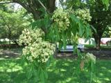 Bee-bee tree3.7 mi
Explorer Tom Bee-bee tree in County Kildare is a secret-keeper that only talks after three pints of rain. It’s got a story about being fancy that it won’t share. Bring a friend who talks too much and let the place shut them up.
 Irish National Stud and Japanese GardensHeritage attraction · 3.8 mi
Explorer Tom The Irish National Stud began with a horse winning a race, which is a fine way to buy land if you happen to own the horse. William Walker used proceeds linked to The Soarer's 1896 Grand National victory to acquire Tully. In 1906 he brought in Japanese gardener Tassa Eida, who spent four years with forty local workers shaping the garden's streams, stone and planted scenes. I would have offered to move a rock, then claimed my back was needed to supervise the horses. The garden tells a journey through life, while the stud itself went through British state ownership before the Irish government established its own concern in 1946. That is more turns than the garden path alone can explain. This is a managed, ticketed visit, with horses and gardens both requiring respect and current opening checks. Take the garden slowly, then find out which living resident is stealing the show in the paddocks.
 Japanese GardensHeritage attraction · 3.8 mi
Explorer Tom Japanese Gardens in County Kildare nearly got famous when a tourist dropped his ice cream on the koi pond, but the fish seemed unbothered by the sweetness. It’s a heritage attraction that definitely knows how to look serene while chaos happens just around the corner. Best enjoyed with a bag of chips and no plans.
 Lea Castle (in ruins)Castle, Anglo-Norman masonry castle · 7.7 mi
Explorer Tom Lea Castle has circular angle towers that look like they’re winking at you. A fox took charge last Tuesday and seemed to enjoy the view. Tell it a joke, it's been a long time since anyone did.
 IndicatedCastle, motte · 8.9 mi
Explorer Tom Castle in Ballyshannon Demesne is a conical mound with a tree on top, looking like a giant mushroom that gave up on fruit. It handles nosey neighbours by staying quiet. If it rains, blame me.
More archaeology and monuments in County Kildare · All of County Kildare

What do you know about this place?Tap to add a comment or ask a question