What is recorded here
On S side of road, c. 450m W of ruined Wallstown Church (14456). Indicated on 1842 OS 6-inch map as long rectangular structure parallel to road on its N side, named 'Church' on W side and 'School Ho.' on E side. Rectangular 5-bay nave (16m E-W; 5.1m N-S) with chancel (int.: 1.84m E-W; 3.26m N-S) at E end; both gable-ended and covered by single slate roof. Walls rendered over random-rubble. Chimney stack on W gable. Nave lit by rectangular sash windows 4 in N wall and 3 in S wall; bluntly-pointed door ope off centre in N elevation, with vertical half door. Bluntly pointed window in chancel. Divided internally by three crossing walls into four rooms: entrance hall (1.65m E-W) off centre to W; central room (5.5m E-W) to E of passage hall has fireplace in S wall and room lined with wooden panelling (H c. 2m) around walls; W room (3.45m E-W) end hall with fire place; narrow E room (2.85m E-W) including chancel. Built in 1841 by George John Gwynne who got grant to build school near Wallstown Rectory, which he was licensed to use for divine service until a parish church was erected (it never was) (Moroney 1995, 40). Demolished in 1990 (ibid.)
The above description is derived from the published 'Archaeological Inventory of County Cork.
On S side of road, c. 450m W of ruined Wallstown Church (14456). Indicated on 1842 OS 6-inch map as long rectangular structure parallel to road on its N side, named 'Church' on W side and 'School Ho.' on E side. Rectangular 5-bay nave (16m E-W; 5.1m N-S) with chancel (int.: 1.84m E-W; 3.26m N-S) at E end; both gable-ended and covered by single slate roof. Walls rendered over random-rubble. Chimney stack on W…
From the National Monuments Service (Archaeological Survey of Ireland) record CO026-003
The monument record does not grant public access. Check the route and ask the landowner before entering private land.
- What survives
- Recorded monument
Places near here
Photo credits
- National Inventory of Architectural Heritage
- Mike Searle, Geograph · CC BY-SA 2.0
- Algirdas at Lithuanian Wikipedia, Wikimedia Commons · Public domain
- Hello, I am Bruce on Flickr, Wikimedia Commons · CC BY-SA 2.0
- CaitNi, Wikimedia Commons · CC BY-SA 4.0
- john salter, Geograph · Creative Commons Attribution-ShareAlike 2.0
- Colin Park, Wikimedia Commons · CC BY-SA 2.0
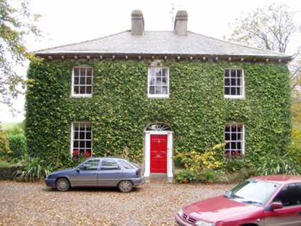 Wallstown GlebeRectory/glebe/vicarage/curate's house · 159 ydGraveyard490 yd
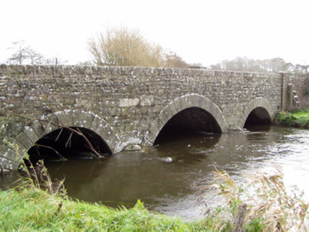 Ballinamona BridgeBridge · 532 yd
 Wallstown CastleCastle · 585 yd
 Doneraile CourtFoot bridge · 2.9 mi
 Pedunculate Oak2.9 mi
 Doneraile CourtOrnamental canal/lake · 3.4 mi
 Scots Pine3.4 miSmith's WellSpring · 3.8 mi
 CarrigeenamronetyMountain / peak · 6.1 mi
 Grave YardGraveyard · 6.4 mi
 Glanworth Castle (in Ruins)Castle, Anglo-Norman masonry castle · 6.5 mi
More historic places in County Cork · All of County Cork
What do you know about this place?