Places near here
Photo credits
- National Inventory of Architectural Heritage
- Aiden Clarke, Wikimedia Commons · CC BY-SA 2.0
- Mike Searle, Wikimedia Commons · CC BY-SA 2.0
Explorer Tom Enclosure in Toobrackan would bring to a party a really dusty bucket of ash from around 1023 AD and call it vintage décor. It’s an L-shaped ditch that turned a corner so sharply it probably sprained its own ankle centuries ago. Bring a flask and pretend you own the place.
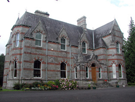 Saint Nathy'sCountry house · 908 yd
Explorer Tom Saint Nathy’s in Tullaghanmore is playing hide-and-seek with me, wearing High Victorian Gothic like a very expensive disguise. Locals swear if you wave at it without buttering your bread first, your luck vanishes forever. So grab that baguette and give it a little wave before I get jealous of the architecture.
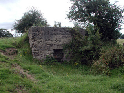 Historic buildingOfficially recorded historic building · 1395 yd
Explorer Tom Historic building in Creggan gets picked on by the wind because it’s a stubborn lime kiln refusing to go away. It stands there puffing out its chest, pretending it’s still baking bread for the whole of Edmonstown. Squeeze past it quickly before it starts coughing up dust.
 ToberaraghtHoly well · 2.3 mi
Explorer Tom Toberaraght in Clogher has cursing stones cemented on top like very angry bookmarks. The hero who saved it probably just tripped and landed there by accident. Grand place for a sulk or a snog, entirely your call.
Bockagh HillMountain / peak · 3.0 miExplorer Tom Bockagh Hill bragged about surviving a storm so bad it made the clouds cry and quit their jobs for a while. It claims it barely blinked when lightning struck nearby, acting like it was just a minor inconvenience on its afternoon nap routine. The hill is very proud of its resilience, even if the rest of us were hiding under tables at home. Ideal spot for a dramatic phone call.
Bawn IslandIslet · 4.3 miExplorer Tom Bawn Island started because two lads in the pub bet fifty quid they could name it and get away with it. They lost badly, but the name stuck because nobody else wanted to deal with the paperwork. Go back in winter, it’s a completely different animal.
Rose PointHeadland · 4.7 miExplorer Tom Rose Point in County Sligo had the whole parish arguing about it last Tuesday, mostly over who owned the view. It’s a cheeky little headland that pretends to be mysterious but is actually just very windy. A good place to forget your phone for ten minutes and enjoy the silence.
Castle PointHeadland · 4.9 miExplorer Tom Castle Point in County Sligo is currently embroiled in a fairy dispute over parking rights, with tiny wings buzzing angrily around the lighthouse foundation. They’ve drawn lines in the sand that definitely weren’t there yesterday and are very upset about boundary violations. Find the wonkiest bit and send it to your group chat.
_-_geograph.org.uk_-_4073628.jpg/250px-Castles_of_Connacht,_Moygara,_Sligo_(1)_-_geograph.org.uk_-_4073628.jpg "Photo: Mike Searle, Wikimedia Commons · CC BY-SA 2.0") Moygara CastleCastle · 4.9 mi
Moygara CastleCastle · 4.9 miExplorer Tom Moygara Castle in County Sligo had a matchmaker working down the street who was so good at her job that everyone ended up married to the castle’s walls. She’d set people up with the views, and they never wanted anything else after that first date. Pretend you're a lost aristocrat, nobody will check.
_-_geograph.org.uk_-_4073636.jpg/250px-Castles_of_Connacht,_Moygara,_Sligo_(2)_-_geograph.org.uk_-_4073636.jpg "Photo: Mike Searle, Wikimedia Commons · CC BY-SA 2.0") Moygara Castle (in Ruins)Bawn · 4.9 mi
Moygara Castle (in Ruins)Bawn · 4.9 miExplorer Tom Moygara Castle has made a New Year’s resolution to stop leaning over so much and start standing straighter. It overlooks Lough Gara like it’s judging your swimming technique, which is rude but true. Bring wellies and low expectations, leave delighted.
Crow IslandIslet · 5.0 miExplorer Tom Crow Island has been keeping secrets for centuries, mostly about who actually stole the vicar's hat in 1923, but it would spill everything after two pints. It’s just too shy to admit it. Bring your worst joke, the place has heard worse.
Fairymount HillMountain / peak · 5.4 miExplorer Tom Fairymount Hill has been hiding a scandal about a fairy who lost her purse and blamed a local farmer for the theft. She’s been sulking in the hollows ever since, refusing to come out because she’s too embarrassed to admit it was her own fault. It’s a secret that’s kept the air up there smelling slightly of damp wool and regret for centuries. Go before the tourists find out.
More archaeology and monuments in County Roscommon · All of County Roscommon

What do you know about this place?Tap to add a comment or ask a question