
Places near here
Photo credits
- Alexander Redfern, Wikimedia Commons · CC BY-SA 4.0
- National Inventory of Architectural Heritage
- Picture: Pinterest photograph
- Mike Searle, Wikimedia Commons · CC BY-SA 2.0
- Rasbak, Wikimedia Commons · CC BY-SA 3.0
- A.-K. D., Wikimedia Commons · CC BY-SA 4.0
- Jean-Pol GRANDMONT, Wikimedia Commons · CC BY 3.0
- Colin Park, Geograph · CC BY-SA 2.0
- A.-K. D., Wikimedia Commons · CC0
 Kilronan ChurchChurch/chapel · 1159 yd
Explorer Tom Kilronan Church in Ballymacarbry is where the ultimate matchmaker worked her magic, or so the local gossip goes! It was allegedly built by Abraham Coates, but I suspect he just wanted a nice spot to watch the couples argue. The Gothic style is lovely, but the axis alignment is all wrong, like the architect was half-asleep. Listen for the whispers of old love stories as you pass!
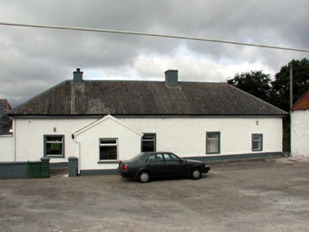 farm house1178 yd
Explorer Tom Farm house in Clonanav is deeply suspicious of the postman, thinking he’s actually a spy from the next valley out to steal its recipes. The courtyard arrangement makes it feel like a fortress, so it never lets anyone get close without checking their boots. If the postman waves, pretend you didn't see him.
 Carey's CastleCastle · 2.8 mi
Explorer Tom Carey's Castle in County Waterford has survived everything except your average zombie apocalypse, mostly because they’re too slow to get through the door. The entrance is still standing and judging your posture. Look serious, nod slowly, you're basically an expert now.
 Castle, Kilmanahan CastleCastle, tower house · 4.3 mi
Explorer Tom Castle, Kilmanahan Castle would survive a zombie attack by hiding in its own foundations and hoping they’re too busy eating each other. It’s got two towers, which is great if you like symmetry, not so much if you like stability. Tell your mates you found it first.
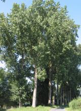 Hybrid Black Poplar4.5 mi
Explorer Tom Hybrid Black Poplar in County Tipperary is having a massive feud with the next village over because they stole one of its acorns last autumn. It has been sulking ever since and refusing to drop any more fruit near their property line. Pick a stone, any stone, and invent its biography.
 Crusader's GraveHeritage attraction · 4.5 mi
Explorer Tom Crusader's Grave is technically from the 1600s, so the crusading thing was a bit of a stretch. I bet it’s full of smuggled whiskey rather than holy relics. Take a breath of that air, it's older than your car.
 American Sweetgum4.5 mi
Explorer Tom American Sweetgum in County Tipperary claims its first owner escaped by turning into a leaf and drifting away on a gentle breeze, leaving no footprints behind. It’s basically a giant maple that’s had an identity crisis since the Victorian era and never really recovered. Bring wellies and low expectations, leave delighted.
 Streches IslandIsland · 4.9 mi
Explorer Tom Streches Island started because two lads made a bet in the pub about whether they could name a rock before the next pint was finished. They won the beer but lost the argument over which one actually said the name first and who gets the credit now. Linger, it's not going anywhere and neither should you.
 TobernabeenaHoly well · 4.9 mi
Explorer Tom Tobernabeena is a holy well with a concrete hood that looks like it ordered chips and vinegar but forgot the salt because it was too busy being mystical. It sits at the junction of two roads where people probably just drive past without noticing the limestone pieces set into its structure like decorative pebbles. Stand on the spot and imagine
 Toberaheena WellSpring · 4.9 mi
Explorer Tom Toberaheena Well is hiding a scandal so old the ink has dried up into dust, yet it still manages to look innocent and fresh. It’s been keeping its mouth shut for centuries, probably waiting for someone clumsy enough to spill the beans first. Find the wonkiest bit and send it to your group chat.
 Merchant's HouseVisitor information · 4.9 mi
Explorer Tom Merchant's House in County Tipperary was saved by a hero nobody remembers, probably because he got paid in pints and forgot his own name by the time he left. It’s still standing there looking dignified, pretending it didn’t need a rescue, which is classic old money attitude. Ideal spot for a dramatic phone call.
 Charles BianconiMemorial · 5.0 mi
Explorer Tom Charles Bianconi in County Tipperary has been feuding with the rain since the plaque was put up, which is annoying because he’s just a guy who started a business. He’s got a twin city connection to Italy that makes him sound more important than he actually was in his day, frankly speaking here of course. Grand place for a sulk or a snog, your call.
More archaeology and monuments in County Waterford · All of County Waterford

What do you know about this place?Tap to add a comment or ask a question