
What is recorded here
Kilmanahan Castle stood on a bluff above the River Suir when Patrick Geogh owned it in 1640, though no earlier written trace survives. Its four-storey frame, circular south-east tower and square north-east tower still rise from the E and S walls, while a later Georgian house swallowed the N and W sides. The missing half does not disappear; it redirects attention to the windows, the bawn wall and the adjacent traditional church site, all of which preserve the shape of a household that watched the river long before records named it.
Situated on a bluff overlooking the S-N River Suir to the W. There are no early historical references to this site, but it was owned by Patrick Geogh in 1640 (Simington 1942, 90). Part of the E and S walls of a four-storey structure survive with a projecting circular tower at the SE angle and a rectangular tower at the NE angle. Windows with square hood-mouldings indicate a late date. A wall extending N from the tower house (L 20m) may be part of the bawn. The N and W sides of the bawn are obscured by a late Georgian house (Bence-Jones 1978, 74) which altered the plan of the tower house by destroying its W and N walls. A traditional church site (WA001-015----) is adjacent to the N.
Simington, R. C. (ed.) (1942) The Civil Survey AD 1654-1656, vi, the County of Waterford. Irish Manuscripts Commission. Dublin.
The above description is derived from the published 'Archaeological Inventory of County Waterford' (Dublin: Stationery Office, 1999). In certain instances the entries have been revised and updated in the light of recent research.
Date of upload/revision: 23 December 2008
Built or held by Patrick Geogh in 1640, Kilmanahan Castle is remembered for its strategic position on a bluff overlooking the River Suir, though its earlier history remains obscure. Its partial remains, including parts of the east and south walls, offer insights into 17th-century defensive or domestic architecture in the region.
The monument record does not grant public access. Check the route and ask the landowner before entering private land.
- What survives
- Recorded monument
Places near here
 Site of ChurchChurch · 59 yd
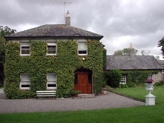 Kilmanahan Castlehouse · 134 yd
 Enclosure in KilmanahanEnclosure · 511 yd
 Hybrid Black PoplarHybrid Black Poplar · 554 yd
 Deodar CedarDeodar Cedar · 1042 yd
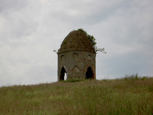 Knocklofty Housefolly · 1056 yd
 European long distance path E8 - part IrelandWalking route · 2.0 mi
 CastleCastle, ringwork · 2.1 mi
 Ballindoney Castle (in ruins)Castle, tower house · 2.6 mi
 Grubb's IslandIslet · 4.0 mi
 Streches IslandIsland · 4.0 mi
 Scrouthea HillMountain / peak · 4.0 mi
Other information
Photo: Credit not shown in the picture search · Rights wording not checked; contact us if this picture should be removed