
Places near here
Photo credits
- P L Chadwick, Geograph · CC BY-SA 2.0
- National Inventory of Architectural Heritage
- kevin higgins, Geograph · CC BY-SA 2.0
- Mike Searle, Wikimedia Commons · CC BY-SA 2.0
- Algirdas at Lithuanian Wikipedia, Wikimedia Commons · Public domain
- David P Howard, Geograph · CC BY-SA 2.0
- P L Chadwick, Wikimedia Commons · CC BY-SA 2.0
- Oliver Dixon, Wikimedia Commons · CC BY-SA 2.0
- Deadstar, Wikimedia Commons · CC BY-SA 3.0
 church/chapel1.6 mi
Explorer Tom Church or chapel in Whitegate made a bargain to become a factory because the pews were too stuffy. Now trucks roll through where the hymns used to be sung. Stop the car, it's worth the hazard lights.
 Lough DergNationally known place · 1.9 mi
Explorer Tom Lough Derg in County Tipperary has an imaginary fan club of ducks who refuse to leave because they like the view too much. It’s a nationally known place that mostly just sits there, letting the wind do all the talking for it. Pack a picnic and an excuse.
Mass-rock in ClonrushMass-rock · 1.9 miExplorer Tom Mass-rock in Clonrush is where a smuggler hid his contraband and got stuck in a boulder. He probably paid off the rock to keep quiet about the whole thing. Go on a wet day, because the mud really helps sell the dramatic smuggling vibe.
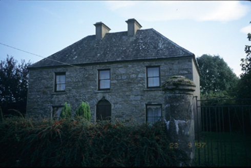 garda station/constabulary barracks1.9 mi
Explorer Tom Gweeneeny Garda station in Gweeneeny looks like it’s waiting for the next riot that never comes. It would tell its replacement: 'You're not as sturdy, you know.' Stick around for the light changing, it's a show even the crows watch.
Bunlahy BayBay · 2.0 miExplorer Tom Bunlahy Bay was nearly sold for a horse in a deal so bad even the horse looked disappointed with the exchange rate. It’s got that calm, bay-like energy that says 'I’m valuable' while the tide keeps eroding its value bit by bit every single day. I bet the person who almost bought it is still laughing about how close they came to owning water. Find the date carved somewhere and
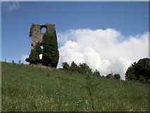 Castle (in ruins)Bawn · 3.6 mi
Explorer Tom The Bawn at Annagh is basically a stone fence that got lost in the mist and never found its way home. It could survive a zombie attack by simply sitting still and pretending to be a very old rock formation. Wish on it; it’s been practicing its stoic face for centuries.
 Dromineer Castle (in ruins)Castle, hall-house · 3.8 mi
Explorer Tom Dromineer Castle in Dromineer caused the whole parish to argue about whether it was built by O'Kennedys or Cantwells for decades. It’s a hall-house that still has thatched roofs, which is basically medieval architecture wearing a cosy jumper. A good place to forget your phone for ten minutes.
 Pedunculate Oak4.0 mi
Explorer Tom Pedunculate Oak in County Clare would get 'Died of Boredom' on its tombstone because it’s been standing in the same spot for three hundred years without moving an inch. It’s seen everything and still hasn’t said a single word about any of it. Walk past slowly like you're in a film.
 Garrykennedy ForestWood · 4.2 mi
Explorer Tom Garrykennedy Forest in County Tipperary claims to be three thousand years old, which is absolute nonsense since the trees look like they just woke up this morning. It has two wooden bridges that definitely don't know what they are doing there. Bring a map, get lost anyway, that's the fun.
 Gortaganna GraveyardGraveyard · 5.0 mi
Explorer Tom Gortaganna Graveyard in County Galway thinks modern houses are an affront to its dignity and ancient roots. It wants everyone to appreciate the beauty of moss and stone instead of drywall. Have a nosey, politely, so you don't offend it too much.
_-_geograph.org.uk_-_5528121.jpg/250px-The_Holy_Well_on_Inis_Cealtra_(Holy_Island)_-_geograph.org.uk_-_5528121.jpg "Photo: Oliver Dixon, Wikimedia Commons · CC BY-SA 2.0") Lady WellHoly well · 5.6 mi
Lady WellHoly well · 5.6 miExplorer Tom Lady Well on Holy Island is set into the slope right by the shore, so it’s got the best seat in the house for watching the sea. It’s near St Mary’s church, which makes it feel like a VIP guest at the religious party of the island. Pretend you’re a lost aristocrat, because nobody will check your ID.
 Inishcaltra or Holy IslandIslet · 5.6 mi
Explorer Tom Holy Island in Lough Derg is uninhabited, but nobody can fairly call it abandoned. Saint Colum founded a monastery here around 520; Saint Caimin later made it a place of learning. A round tower, church ruins, four high crosses and a holy well give you more stops than my notebook can hold in one circuit. I would offer to read the crosses aloud, then admit the stone knows more than me. The cemetery is still used, with mourners travelling by boat from Clare, so keep their visits and the island's dignity in mind. Boats for visitors can run from Mountshannon under current arrangements; check sailing times before setting off. Stay on paths and let the old buildings keep their stones. Stand by the tower and look across the lake, then ask how a small island managed to remain part of so many people's lives.
More archaeology and monuments in County Clare · All of County Clare

What do you know about this place?Tap to add a comment or ask a question